Updated 08.00 | Published 07.57
unsaveSave
expand-left
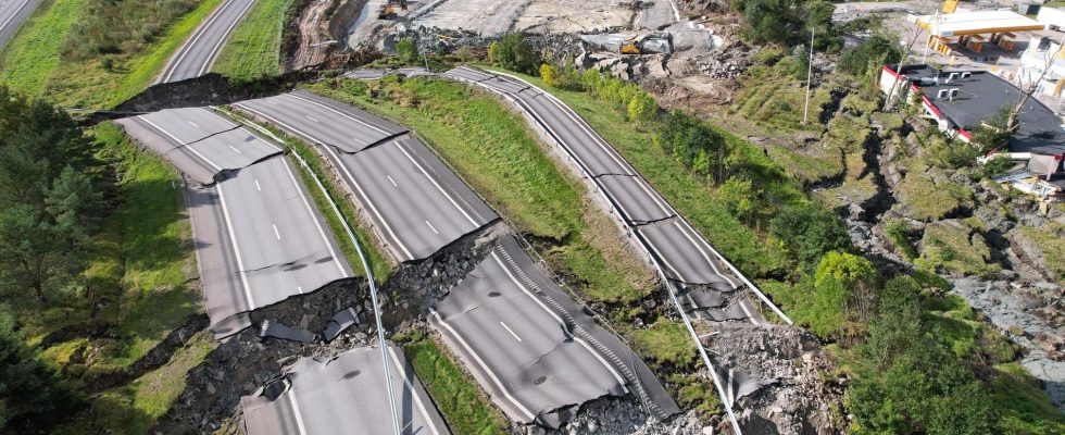
full screen The landslide occurred on the E6 outside Stenungsund in September. Archive image. Photo: Hanna Brunlöf Windell/TT
There are crucial errors in the foundation behind the building that collapsed in the landslide in Stenungsund in September, reports SVT Väst.
According to a map, the land that collapsed in the landslide was stated to consist of superficial rock – and thus withstand high loads. But the map was wrong and there was no mountain in the place.
According to the Norwegian Geotechnical Institute, SGI, the map influenced the assessment of the landslide risk before the construction, where a business park was to be built.
– It is regrettable, especially when it became of such decisive importance for the interpretation we made of the landslide conditions in the area, says David Rudebeck, geotechnician at SGI.
Precisely in the slope that collapsed, no drilling was carried out to examine the ground, which was done in several other places in the area.
– The landslide would not have occurred if you had known about it, says Mats Karlsson, researcher in geotechnics at Chalmers University of Technology, to SVT.
The responsible company Norconsult writes in an email to SVT that due to the accident commission’s ongoing investigation, it does not want to comment on the matter.