The Odyssey, told by Homer, is one of the best-known mythological stories. Ulysses, the hero crosses the Mediterranean and it is tempting to try to retrace his journey on our current maps. But is it really possible?
You will also be interested
[EN VIDÉO] Do you know these myths about prehistory? Antoine Balzeau, paleontologist at the National Museum of Natural History, regularly tackles the exercise of popularization. Dissemination of knowledge to the general public. Author of the book “33 received ideas about prehistory”, he revealed some of them to Futura.
One of the best known mythical epics is certainly The Odyssey which traces the journey of Odysseus, Greek hero of the Trojan War. Recounted by Homer, this adventure story dates from the end of the 8thand century BC
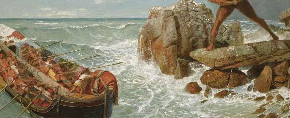
Although mythological, this story takes place in a real geographical context, that of the Mediterranean basin. It describes Odysseus’ sea voyage to return home, on the island of Ithaca, after the destruction of Troy. A journey that will last ten years and during which Ulysses will meet many mythological characters as the nymph Calypso, the princess Nausicaa, the Cyclops, the sirens or even the magician Circe.
Between fiction and reality
It remains to disentangle the true from the false. In addition to the question of knowing if Ulysses really existed or if he represents only a fictitious character, many authors and analysts have sought to know if the numerous geographical references present in the story correspond to real places. From Antiquity, Polybius and Strabo thus attempted to retrace the path followed by Ulysses. But all is not so simple because if, among the places mentioned by Homer, some are easily identifiable and transposable on current maps, such as the islands of the Mediterranean or certain coasts, others seem completely imaginary. This is the case of the underground world recounted by Homer, the land of the Lotus-eaters or even thearchipelago of the Phaeacians. In 1858, William E. Gladstone concluded that The Odyssey is thus a skilful mixture of fiction and reality and that it is futile to attempt to map it.
A little later, Samuel Butler, a 19th century novelistand century, also attempts to map the journey of Ulysses. It is then based on the topographical information provided by the story: descriptions of forests, mountains or coasts. According to him, most of this information refers to places located in Sicily or its surroundings. Ulysses would therefore not have gone very far.
Ithaca in the Ionian Sea, in Sicily… or in Gibraltar?
In the early 1900s, Victor Bérard, a French diplomat and politician, embarked on a journey that was supposed to follow the route of Ulysses in the Mediterranean. Also basing himself on the topography described in Homer’s work, Bérard identifies places and takes pictures of them. These data, together with its interpretations, will be published in a book, In the wake of Ulysses, in 1933. His map thus positions various places hitherto considered purely imaginary, such as Calypso’s cave, which he places on an island close to Gibraltar. While Bérard’s work has long been authoritative in this area — it is even featured in school textbooks — it is now increasingly contested. Critics rely in particular on the fact that he wanted at all costs to demonstrate that The Odyssey was an entirely realistic narrative.
However, the location of the island of Ithaca itself, the end point of Ulysses’ journey, is debated. Naturally, the cartographers who worked on The Odyssey placed it in the Ionian Sea, on the island which gate currently the same name. This choice is also supported by the fact that Homer describes a set of four islands, of which Ithaca would be the least suitable for chariot racing. The topography and the geographical context could therefore correspond. But many authors disagree, some positioning Ithaca on another Ionian island, others locating it in a completely different place in the Mediterranean, in particular to the west of Sicily, or much further, in the vicinity of Gibraltar. .
The most important thing: let yourself be carried away by the magic of the story
So perhaps the question is not whether it is possible to map Odysseus’ journey, but rather whether it makes sense to do so. Indeed, simply transposing topographical and geographical observations dating from 2,800 years ago seems to have little meaning, if one does not take into account the modifications that the coasts have undergone during all this time, in particular because of variations in sea level and natural or anthropogenic coastal erosion.
The fact is that Homer himself did not consider it necessary to include in his narrative even an approximate map of his hero’s journey. Perhaps we should not look any further and simply let ourselves be carried away by this beautiful adventure story.
Interested in what you just read?