
Cyclone Freddy is due to pass off Reunion Island at the end of the evening on Monday February 20. The overseas department is placed on orange alert in the face of the strong winds and swells that are expected.
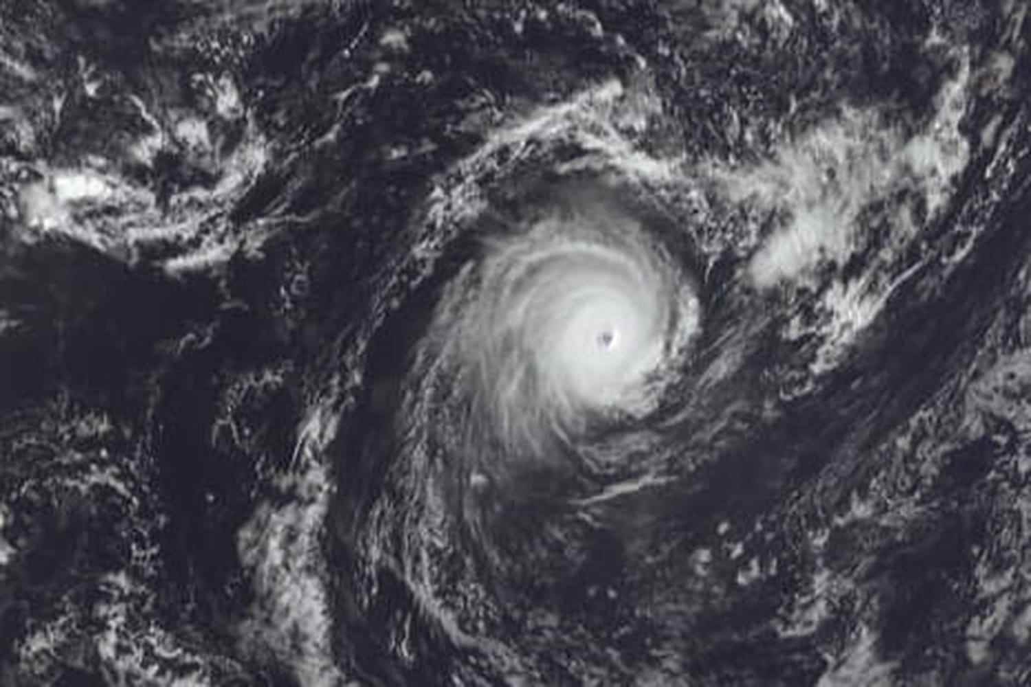
A behemoth evolves in the Indian Ocean. Cyclone Freddy is advancing towards Reunion Island this Monday, February 20, 2023 but must first graze the neighboring island, Mauritius. The French overseas department, placed on orange cyclonic alert, is preparing for strong winds, but the meteorological phenomenon has, fortunately, “lost its intensity during this night and has therefore been downgraded to the stage of Cyclone Tropical Intense according to the morning report of Meteo France. The low pressure system is “powerful and compact generating extreme winds near its center, but the zone of influence of the cyclone is reduced”, details the meteorological agency according to which “little effects [du cyclone sont] felt beyond 200 km from the center”.
What forecast for Cyclone Freddy in Reunion?
Hurricane Freddy could therefore have limited effects on the Reunion coast since according to its anticipated trajectory and the preferred scenario, it should pass 180 km from Reunion in a west-southwest direction. However, the weather conditions deteriorate throughout the day until they become very bad tonight, so it is recommended to stay under cover. After the disturbances at the end of the evening and at night, improvements, rather “rapid” according to Météo France, are expected during the day on Tuesday.
If the dangerous areas of Cyclone Freddy should not affect Bourbon Island, the weather conditions should be disrupted with strong winds: “100 to 110 km/h on the coast, 120 to 130 km/h in the high inhabited areas and [jusqu’à] 130km / h on the summits”, details Météo France. These winds should be accompanied by small amounts of rain on the seaside and more dense in the interior of the island. If the expected volumes are not exceptional, meteorologists warn of “showers [qui] can be intense for a short duration”. “A more pessimistic scenario with a closer passage cannot yet be completely ruled out”, but is practically excluded.
In addition to being on cyclonic orange alert, Reunion must also enter orange wave-submersion vigilance from 4 p.m. this Monday (1 p.m. in Paris) and until 12 p.m. tomorrow (9 a.m. in Paris). Like the gusts of wind, the swell should intensify along the entire east coast of the island, from north to south, with average waves of 5 to 6 m, more rarely up to 7 m, in the evening. The highest waves can reach 11 to 13 m.
Reunion on orange alert
The orange hurricane alert was triggered on Sunday February 20 at 7 p.m. All public services are mobilized and all schools closed on Monday. Residents are urged to take precautions and stay sheltered as much as possible. It is not recommended to approach the seaside. The authorities and Météo France are monitoring the situation closely to adapt the level of vigilance if necessary.