IGN will use artificial intelligence to map land use in France more quickly and more precisely. A technological first at the service of a major issue in the ecological transition.
The Earth is in constant evolution, whether because of climate change, which accentuates environmental phenomena such as heat waves, storms, forest fires or floods, or because of human activity, with deforestation and pollution. ‘urbanization. France is no exception. This is why the Government has commissioned a study from the National Institute of Geographic and Forest Information (IGN) aimed at collecting consistent land use data at the national level, delivered at short intervals.
Mapping the evolution of soils in France
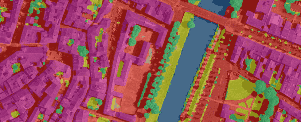
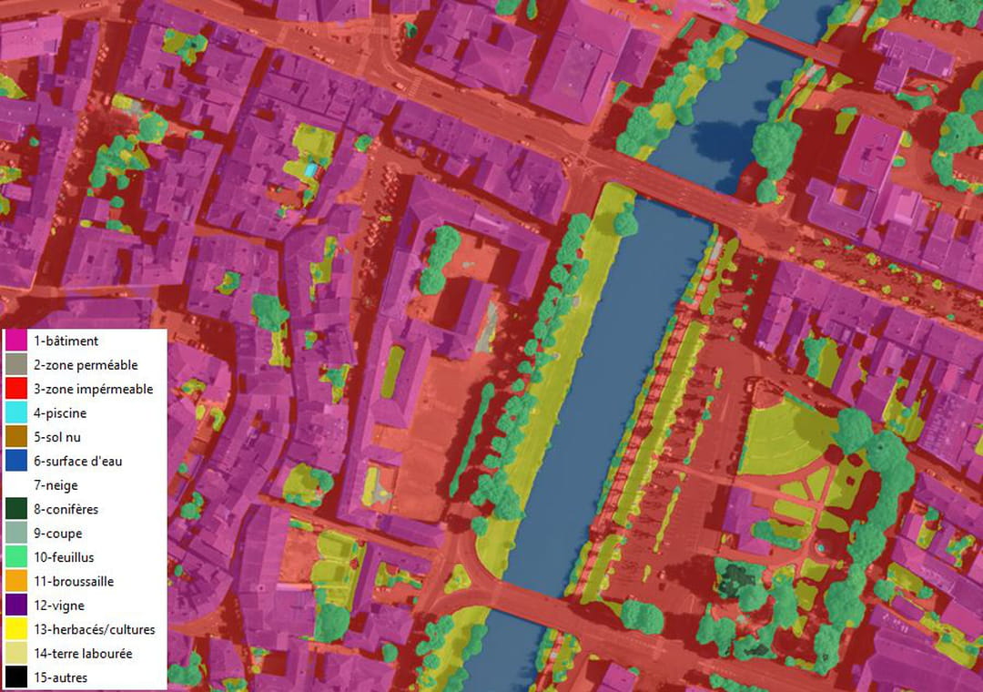
To be able to observe French territories and their evolution, IGN used artificial intelligence (AI), via deep learning methods – also called deep learning – which make it possible to automatically recognize objects, such as buildings, trees and asphalt surfaces, which constitute the different classes of land cover on aerial or spatial images. The map therefore shows the aerial view with 15 different colored filters. For example, conifers appear in dark green, leafy trees in light green, water surfaces in dark blue, swimming pools in light blue, buildings in pink… The models deep learning used here are composed of millions of parameters, which are then adjusted in a learning phase based on a very large number of examples of what one wishes to obtain as a result. To make it simpler, the IGN has taken examples of maps where the outlines of buildings, trees, asphalt surfaces, etc. appear. The model then tested a multitude of parameterization combinations until it obtained the result closest to the examples. All this maneuvering requires enormous computing power!
For the moment, this national system for measuring soil artificialization has only been deployed in the Gers department (32). The coverage of the metropolitan territory and the overseas departments and regions (Drom) will be achieved by 2024. In parallel, a new deep learning model called “whole France”, aimed at generating predictions for all departments, is being created. The results of these two programs will be published gradually on the site geoservices.ign.fr. They will be made available to all in open data, in a process of common enrichment. In any case, researchers can already take inspiration from Google Dynamic World, a spectacular tool that displays the state of soils around the world on maps updated in near real time with unprecedented precision.