Content item
The forecast of increasing wind speeds later Tuesday into the evening has prompted the Lower Thames Valley Conservation Authority to issue a flood watch for the Lake Erie shoreline.
Content item
There is a risk of flooding along Erie Shore Drive near Erieau, beginning early Tuesday evening and lasting through Wednesday morning, the flood watch stated.
Winds are forecast to come from the southwest or south by Tuesday afternoon, with wind speeds beginning to climb.
Down on the Lake Erie shoreline, sustained wind speeds could reach 35 kilometers per hour by early in the evening before a predicted overnight peak of sustained speeds in the 40 to 50 km/h range, as well as tastes possibly approaching 80 km/h, the conservation authority said.
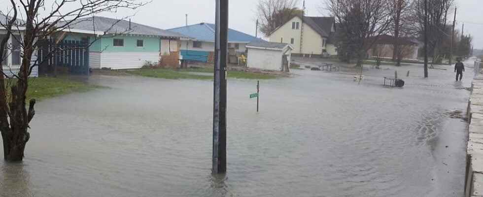
“Should the predicted peak wind speeds of 40 to 50 km/h be reached, there could be flooding similar to what was seen last week,” the conservation authority said.
The flooding seen on Jan. 11 was associated with winds between 40 and 50 km/h over a six-hour period.
Residents in the area should pay close attention to local conditions and be prepared, the conservation authority warned. There could also be impacts to other low-lying shoreline areas that have seen flooding over the past few years.
Due to high lake levels, there is a risk that wave action could damage shoreline protection works and cause erosion all along the Lake Erie shoreline in Chatham-Kent and Elgin County, including along the high bluff areas.
The Lake Erie shoreline has yet to freeze over along most of its length in the Lower Thames Valley region. Wave forecasts for Lake Erie are calling for waves around 1.5 to 2 meters in near-shore areas and two to three meters on the open lake, the conservation authority said.
Content item
Currently, there is no risk of issues along the Lake St. Clair shoreline, as that lake has frozen over.
Temperatures are predicted to rise above freezing early Tuesday afternoon or early evening.
People should take extra caution and avoid the shoreline conditions should get rough. The waves can be strong and the shoreline slippery, the conservation authority said. There could also be hazardous debris within the waves and water which could be thrown onto the shore.
Standing water can also present unseen hazards. Children and animals should be kept away from the water.
Officials will continue to monitor the situation and update this advisory if necessary. However, due to the overnight nature of this event, conservation authority staff may not be able to upgrade this notice to a flood warning.