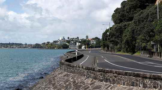
Millimeter by millimeter, the lands of the New Zealand coast are being eaten away by the rising waters. According to recent projections from an extensive research program, “NZ SeaRise”, conducted over five years by dozens of scientists, the sea level is rising twice as fast as expected in some parts of the archipelago. The capital, Wellington, could experience a sea level rise of 30 centimeters by 2040, which was not expected until 2060.
This acceleration is due to a cumulative effect: in addition to global warming which creates a rise in sea and ocean levels of 3.5 millimeters per year on average, there is a phenomenon of land subsidence, also called subsidence. In New Zealand, some coastal areas are already sinking three to four millimeters a year.
While the IPCC predicts global sea level rise of 1.10 meters by 2100, in the worst-case scenario, soil subsidence is therefore an aggravating factor. “If we follow this scenario, in areas where the ground is moving, the rise in sea level will not only reach 1.10 meters in 2100, but 2 meters”, analysis for L’Express Laurent Labeyrie, oceanographer, former member of the IPCC and research director at the CNRS.
Consideration of multiple factors
New Zealand and international researchers have analyzed 7,400 points on the archipelago’s coastline, making it possible to offer maps accessible online with rare precision. “The strength of this study is to have taken into account both the rising waters and the subsidence of the soil on a local scale, depending on the specificities of the territory. It must serve as an example”, adds Laurent Labeyrie.
“New Zealand is facing a problem of global dimensions, but all countries must be vigilant in order to anticipate and have their own responses”, abounds Hervé Le Treut, climatologist at the Academy of Sciences. This concerns estuaries and deltas, where groundwater is pumped for irrigation or oil exploitation; but also port cities, especially if they are densely populated and urbanized. In those areas where the ground supports more weight, it can sink a centimeter per year, such as in Miami.
All these cities, not to mention the smaller ones also affected, will not disappear overnight, however. Rather, they will have to deal with marine flooding, i.e. increasingly frequent and significant flooding, erosion of the coastline which is accentuated, or even water sources which risk becoming unsuitable for consumption due to infiltration…
Sufficient protections?
If port cities are particularly vulnerable, it is because they are built barely above sea level, if not below it. No one realizes this – except in exceptional circumstances – because they are protected by dikes which prevent high tides or exceptional tides from penetrating.
“What matters is how far it is protected?”, raises Laurent Labeyrie: “The richer a country, the higher it protects itself. But if the sea level rises by 20 centimeters, an exceptional event can be enough to disrupt everything, cost a lot of money and cause injuries and deaths.” The risk of submersion, already amplified by the rise in water levels, is all the more increased as extreme events will be multiplied by global warming.
With land subsidence, countries have less time than expected to plan how to adapt to these risks. Among the solutions, the increase in dykes, the relocation of inhabitants living along the coasts, the displacement of cities, following the example of the Indonesian capital, Jakarta, which will be displaced from 2024, or, as recommended by the researcher in coastal dynamics at the Research Institute for Development (IRD), Rafael Almar, “the implementation of sustainable solutions aimed at strengthening the natural ecosystems that protect us, such as dunes or coastal lagoons”. The oceanographer Laurent Labeyrie calls for dealing with the problem at the source: “We must stop adding greenhouse gases to the atmosphere, so that the sea level stops its rise.”
