Posted ,
Reading 1 min.
Google has just added a new feature to its Maps mobile application that allows you to display the air quality near your home. At this time, this data is only available in the United States.
Google Maps now allows you to know the quality of the air, whether in its Android or iOS version. It is in fact a new layer of map details, after transport, cycle paths or even the state of traffic.
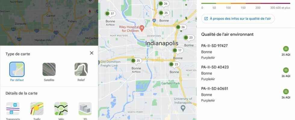
To access it, click on the icon of the different types of cards then select “Air quality” in the section “Card Details”. The information will then appear automatically on the map, in the areas concerned, with a color code and an index indicating the recently measured air quality.
By scrolling the results, detailed access to the whole air quality of a district or a city appears. Note that for the United States, the only countries for the moment where this data appears, the results are provided by the Environmental Protection Agency and the PurpleAir network. Their atmospheric sensors measure the amount of pollutants in the air.
In the future, this service must become international and mobile users should soon be able to receive information on air quality in their region thanks to information provided by local partners.