The various American atmospheric study organizations all agree on the fact that the Atlantic hurricane season, which begins in June, will be intense with around 20 phenomena forecast, including 8 to 10 hurricanes. In question, the abnormal heat of the water and the persistence of the La Niña phenomenon.
You will also be interested
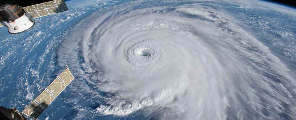
[EN VIDÉO] A look back at an exceptional 2020 hurricane season As meteorologists predicted earlier this year, the 2020 North Atlantic hurricane season has been extremely active. As of November 30 – the official end of the season – no less than 30 tropical storms have been named. Against only 12 for an average season. And it was especially at the end of the season that the hurricanes were the most violent.
After two particularly active years in terms of activity cyclonic, the 2022 season promises to be violent again in the North Atlantic. Between 1991 and 2020, there were 10 to 12 hurricane phenomena per year on average, of which 7 hurricanes, including 3 majors. However, in 2021, 21 phenomena formed, generating 7 hurricanes, including 4 adults. Even if the 2021 season was remarkable, it did not reach the record figures of the year 2020, with 31 phenomena, including 14 hurricanes and 7 major ones!
Just over a month before the official start of the North Atlantic hurricane season (from June to November), the forecasts of the various American reference organizations in the study of the climate have been updated. Their projections are clear: the conditions for 2022 are looking very similar to those of 2021, but not as exceptional as those of 2020.
The Climate Adaptation Center and The Weather Company predict an average of 20 to 22 hurricane phenomena, including 8 to 10 hurricanes, including 4 to 5 major ones. Accuweather and Colorado State University expect just under 20 events (16 to 20), a lower number than other agencies, but still significantly above the average of the past 30 years. In recent years, in addition to an increase in the number of hurricane phenomena, we have observed a lengthening of the hurricane season: while it is supposed to start in June, phenomena have begun to form as early as May every years since 2015.
Climatic conditions are met for more intense phenomena
Two climatic parameters explain these alarmist forecasts for the 2022 season: water temperature very high in the Gulf of Mexico, the main fuel for the formation of hurricanes, and the persistence of the La Niña phenomenon. In some areas of this gulf, the water temperature is currently 4°C above seasonal averages: it locally reaches 27°C, a temperature that could already allow the formation of hurricanes, in the middle of the month of april !
Another parameter to take into account, climatic phenomena El Nino and La Nina which occur in phases of one to two years. These phenomena are characterized by anomaly temperature of part of the waters of the Pacific Ocean: La Niña occurs when the water is colder than average, conversely we speak ofEl Nino when the water is warmer than average. The consequences of an El Niño or La Niña year are strongly felt on the climate of many countries, and on the cyclone phenomena in the Atlantic which are more numerous with La Niña.
The latest projections estimate that La Niña should persist throughout the summer, before weakening in the fall. During a La Niña phase, the shear of the winds at altitude is lower, allowing tropical storms — the stage of the tropical phenomenon which occurs before that of the hurricane — to rise very high and thus to strengthen. Conversely, El Niño causes much more wind shear, which limits the growth of tropical storms.
The 2022 Atlantic hurricane season will start in less than one month (May 15th) and with a La Niña most likely to persist through peak season an active season is favored but how active is the question. The Atlantic SST configuration currently resembles more of a -AMO. Thread 1/3 pic.twitter.com/0Gm2pQVGas
— Anthony M (@AnthonyMweather) April 18, 2022
With these two parameters, the abnormally warm water of the Gulf of Mexico and the persistence of the La Niña phenomenon, a simple depression that would form in the ocean increases its chances of rapidly strengthening into a hurricane.
Interested in what you just read?