You will also be interested
[EN VIDÉO] How do thunderstorms form? France has an average of 250 days of storms per year. How and why are these powerful phenomena born, accompanied by lightning and thunder?
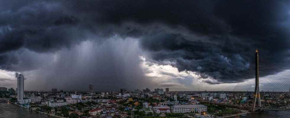
Perth is characterized by a Mediterranean climate very hot, and during the summer, the capital of Western Australia is often the scene of violent storms very rainy. This is precisely what happened on this February 2020 timelapse : a storm cloud seems to burst and pour a mountain of rain on the city.
It is a ” cloudburst “, or more exactly of a ” microburst » humid: on very hot summer days (February being the hottest month in Perth), the thunderstorms that form are characterized by violent updrafts and downdrafts. These sometimes prevent precipitation of the storm cloud to fall, and when the updrafts weaken, the cloud can no longer contain all the accumulated water and it falls suddenly, all at once. Witnesses to this kind of phenomenon, which can occur anywhere in the world, often describe having the impression that a “lake is falling on their heads”!
This cloudburst generates torrential precipitation in a very localized way, accompanied by winds at more than 100 km/h. In the regions of the world most affected by this phenomenon (America, Australia, Antilles, etc.), cloudbursts are able to generate 30 to 50 mm of rain in 1 to 3 minutes. The consequences in town can be devastating for a few hundred meters, but the most violent cloudbursts usually occur in the mountains.
Interested in what you just read?