In the Gale crater, the Curiosity rover continues to provide us with information on the geology of Mars, on its past environment and in particular on the presence of water.
You will also be interested
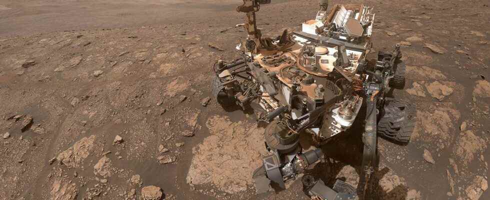
[EN VIDÉO] Curiosity: breathtaking views from the side of Mount Sharp Nine years after its landing on Mars and almost as long to cover the bottom of the Gale crater, the Curiosity rover continues its journey on the red planet on the side of Mount Sharp – also called Aeolis Mons. And it continues to return extraordinary images to astronomers curious to learn more than the climatic conditions that may have prevailed on the red planet in the past. (in English) © NASA, Jet Propulsion Laboratory
Since 2012, the Curiosity rover surveys the Martian floor of the Gale crater in order to understand the past environment of Mars. After having studied the fluvio-deltaic deposits and lake of Aeolis PalusCuriosity took an interest in the geology of Aeolis Mons, the 5,500 meter high building located in the center of the crater. Since 2019, it is now in an area called Glen Torridon, which corresponds to a small valley incising the side ofAeolis Mons. This region is of particular interest to scientists because of the suspected presence of minerals clayey. However, the clays are well known on Earth for promote the preservation of organic matter. Glen Torridon would therefore be an ideal area to search for the potential presence of ancient biological markers. But the interest of scientists goes further. This clay unit would indeed be covered by a sulphate-rich unit. This mineralogical and stratigraphic transition could indeed be the marker of a major modification of the weather Martian, which would have occurred around the Noachian-Hesperian transition (about 3.5 billion years ago). The analysis of the soil of Glen Torridon therefore appears to be essential to understand the past of Mars and its evolution.
The bottom of the Gale crater was certainly a lake
Curiosity therefore used its instrument ChemCam to analyze the composition of the soil in this region. The rover thus seeks to quantify the presence of several minerals containingoxygen (SiO2TiO2AlO3FeOTMgO, CaO, Na2O and K2O) as well as others chemical elements. The Chemical Weathering Index was also estimated for each sample.
The results of the mineralogical analyses, published in the journal JGR-Planetsshow that the strata clayeys examined by the rover in Glen Torridon were certainly buried under several hundred meters of sediment, which would have subsequently been removed by erosion processes until obtaining the current landscape of Aeolis Mons. Some clay sediments suggest they were deposited in a calm lake environmentwhile others are characteristic of a more dynamic environment, such as the banks of a river or a lake.
Presence of water at each stage of sediment formation
The data also allows the history of chemical weathering at Glen Torridon to be traced. The high values of the Chemical Weathering Index suggest that the clayey sediments were weathered by water and that the quantity of water would have been notably sufficient to allow the complete dissolution of certain elements, such as calcium. This episode of chemical weathering by water would have occurred early in the history of the sediments, before, during or quickly after their transport and their deposition in the bottom of Gale crater. After their deposit, the process of diagenesis (lithification sediments) would have been accompanied by the circulation of fluids. The trace of fluid circulation is also attested after the process of diagenesis.
The Curiosity rover captured images of Mars’ Gale crater. © NASA, JPL, Story Ful
It nevertheless appears that the quantity of clay is not higher than in other parts of the crater, as suggested by the orbital measurements carried out by the analysis of the diffraction X-rays. This result is important since it allows better interpretation of the signal observed from theorbit by the Path instrument, especially for future measurements at other locations. It would therefore seem that orbital measurements are not only controlled by the abundance of clay minerals as previously thought.
Interested in what you just read?