You will also be interested
[EN VIDÉO] Kézako: how does a GPS work? The GPS (Global Positioning System), present in many land, air and sea vehicles but also in a majority of smartphones, is now part of our daily lives. Unisciel and the University of Lille 1 explain to us, with the Kézako program, how this system works and reminds us of its history in this short didactic video.
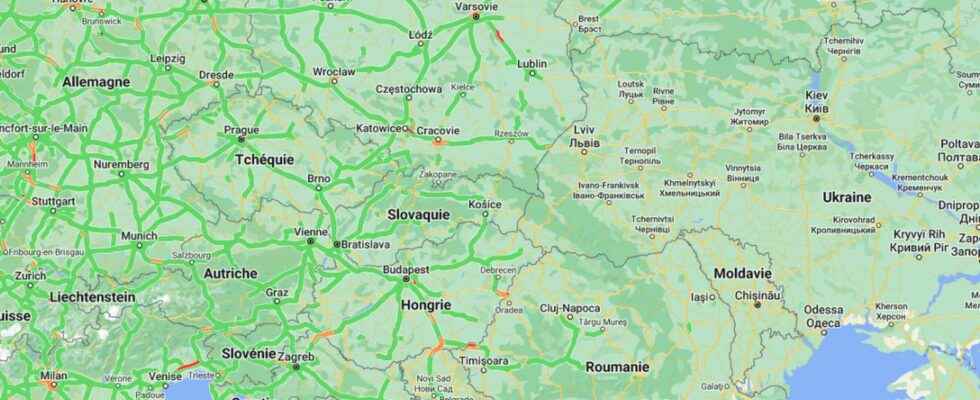
” I think we were the first to see the invasion. And we saw her in a application displaying road traffic in real time “, explained to Vice Jeffrey Lewis, an intelligence expert open-source and teacher at Middlebury Institute in the USA. While Russian troops had been amassed around Ukraine for several weeks, on the night of Wednesday to last Thursday, the expert was able to identify thanks to Google Maps a giant traffic jam on the side of Belgorod, a Russian city near the border and the Ukrainian city of Kharkiv.
In the morning, Russian troops set out to attack the country’s key points. The data collected did not come from smartphones soldiers, since they are now prohibited from activating geolocation on them. They came from the giant traffic jams of civilian vehicles allowing the columns of armored vehicles and other military vehicles of the Russian army to pass.
Civilians taking up arms
According to the expert Jeffrey Lewis interviewed by Vice, the maneuvers with vocation military come to generate areas where traffic is not usual and this is how we can geolocate them. So, if the data from an application intended for everyone can deliver military intelligence, it becomes a useful tool for both sides. Thus, thanks to this type of application, the russian army can potentially identify areas where traffic is difficult in Ukraine to know where both civilians, who are sometimes members of defense battalions, and the military gather.
It is probably for this reason that Google has temporarily chosen to disable tools that provide live information on traffic conditions in Ukraine. Today, on Google Maps, there is no longer any traffic information on the entire territory. After explaining that the shutdown of the feature had been decided for the safety of the Ukrainian populations, in agreement with the local authorities, Google did not give more details, nor whether this measure has already been taken in the past. This deactivation was implemented the day after the dismantling of all road signs on Ukrainian roads.
Support your independent scientific media: discover our subscription formulas!
4 good reasons to subscribe to Futura on Patreon:
- A site without any advertising from 3.29 euros per month.
- It is without commitment.
- Access to priority content, in preview, just for you.
- You support our business in the best possible way. A real motivation for us!
Interested in what you just read?