You will also be interested
[EN VIDÉO] Kézako: how does a GPS work? The GPS (Global Positioning System), present in many land, air and sea vehicles but also in a majority of smartphones, is now part of our daily lives. Unisciel and the University of Lille 1 explain to us, with the Kézako program, how this system works and reminds us of its history in this short didactic video.
After deciding to deactivate the real-time traffic information function in Ukraine In order to protect civilian populations following the Russian invasion launched on February 24, Google Maps has taken a new series of restrictive measures. The map service’s editing tools, which allow users to post geotagged comments, photos, videos and add locations, have been disabled in Ukraine as well as in Russia.
A decision that follows informationunconfirmed, that the russian army allegedly targeted positions added to Google Maps in the days following the invasion of Ukraine by Moscow supporters. ” Due to a recent increase in posts on Google Maps related to the war in Ukraine, we have implemented additional protections to monitor and prevent content that violates our policies, including temporarily blocking new reviews, photos and videos in the region “, announces Google in a press release sent to Futura.
The Californian giant has also deleted all contributions in Google Maps in Ukraine, Russia and Belarus published since the beginning of the war. ” Out of an abundance of caution, we are removing user contributions such as photos, videos, reviews, and business information, as well as all user-submitted locations on Google Maps in Ukraine, Russia, and Belarus since the beginning of the invasion, and we temporarily block new changes “says Google.
The hijacking of Google Maps encouraged by Anonymous
This choice comes after many cases of hijacking of comments in the Russian version of Google Maps. Users have used the files of certain businesses, restaurants, hotels and public places known to post, in particular, photos of the damage caused by the Russian bombings in Ukraine, comments hostile to the invasion and to Vladimir Putin or even the Ukrainian flag. An initiative hailed and encouraged by members of the collective of Hackers Anonymous who have themselves decided to start a cyber war against Russia. “ Go to Google Maps. Go to Russia. Find a restaurant or business and write a review. Explain what is happening in Ukraine “, can we read in a tweet published by the account @YourAnonNews February 28.
For volunteers in search of inspiration, Anonymous even offered turnkey comments of this type: “ The food was excellent! Unfortunately, Putin cut our appetites by invading Ukraine. Stand up to your dictator, stop killing innocent people! Your government is lying to you. Mobilize! »
Translation: The food was great! Unfortunately, Putin spoiled our appetites by invading Ukraine. Stand up to your dictator, stop killing innocent people! Your government is lying to you. Get up!
— Anonymous (@YourAnonNews) February 28, 2022
Following Google’s announcement of temporary restrictions on Google Maps and the removal of comments, Anonymous reacted by publishing the company’s statement preceded by this remark: “ Are you kidding @Google?? “.
Consultation of Google Maps from Ukraine and Russia is still available, but it no longer collects or communicates information on the ongoing conflict.
War in Ukraine: Google Maps traffic information disabled for security
Article of Louis Nephew03/1/2022
To protect civilian populations, Google has temporarily disabled geolocation tools providing live information on traffic conditions in Ukraine.
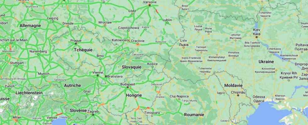
” I think we were the first to see the invasion. And we saw her in a application displaying road traffic in real time “, explained to Vice Jeffrey Lewis, an intelligence expert open-source and teacher at Middlebury Institute in the USA. While Russian troops had been amassed around Ukraine for several weeks, on the night of Wednesday to last Thursday, the expert was able to identify thanks to Google Maps a giant traffic jam on the side of Belgorod, a Russian city near the border and the Ukrainian city of Kharkiv.
In the morning, Russian troops set out to attack the country’s key points. The data collected did not come from the soldiers’ smartphones, since they are now prohibited from activating geolocation on them. They came from the giant traffic jams of civilian vehicles allowing the columns of armored vehicles and other military vehicles of the Russian army to pass.
Civilians taking up arms
According to the expert Jeffrey Lewis interviewed by Vice, the maneuvers with vocation military come to generate areas where traffic is not usual and this is how we can geolocate them. So, if the data from an application intended for everyone can deliver military intelligence, it becomes a useful tool for both sides. Thus, thanks to this type of application, the russian army can potentially identify areas where traffic is difficult in Ukraine to know where both civilians, who are sometimes members of defense battalions, and the military gather.
It is probably for this reason that Google has temporarily chosen to disable tools that provide live information on traffic conditions in Ukraine. Today, on Google Maps, there is no longer any traffic information on the entire territory. After explaining that the shutdown of the feature had been decided for the safety of the Ukrainian populations, in agreement with the local authorities, Google did not give more details, nor whether this measure has already been taken in the past. This deactivation was implemented the day after the dismantling of all road signs on Ukrainian roads.
Support your independent scientific media: discover our subscription formulas!
4 good reasons to subscribe to Futura on Patreon:
- A site without any advertising from 3.29 euros per month.
- It is without commitment.
- Access to priority content, in preview, just for you.
- You support our business in the best possible way. A real motivation for us!
Interested in what you just read?