The tornado that devastated four US states in four hours on December 10 left a ground mark visible from space. If the satellite data is confirmed, it would be the second longest in US history and also the deadliest to date in December, causing the deaths of around 100 people.
You will also be interested
[EN VIDÉO] A powerful computer-recreated tornado Concerned about the hundreds of tornadoes that plague the central United States each year, researchers in that country are trying to better understand the formation of these devastating monsters. Scientists have reconstructed with a supercomputer the tornado “El Reno”, one of the most powerful ever observed, which struck Oklahoma on May 24, 2011. It destroyed everything in its path over more than 100 km for nearly two hours … Grace with this simulation, we can better identify the phenomena at work.
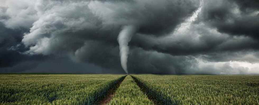
Friday, December 10 tornado break was characterized, both by a large number of tornadoes (75 reported including about 50 confirmed to date) and by the length traveled by a single tornado. The tornado that devastated Mayfield, Kentucky, with winds estimated between 254 and 322 km / h, swept through four states in four hours: Arkansas, Missouri, Tennessee and Kentucky, killing around 100 people.
the Suomi-NPP satellite has captured its track on the ground two days after the disaster, December 12: the trajectory of the whirlwind is 322 km long (including 205 continuous), with an estimated width of 1.2 km. If satellite data is confirmed with field studies, this tornado would be the second longest in US history. Contrary to the first estimates, which suggested that it had traveled from 350 to 400 km, which would have placed it in the first rank of the longest trajectories of tornadoes.
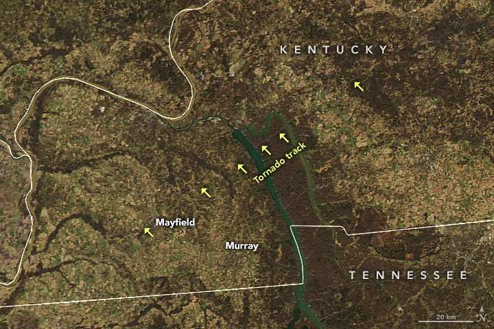
The tornado track is the thin yellow horizontal line above “tornado track”. © NASA
The length record: the “Tri-State Tornado” of 1925
The record for the distance covered by a tornado for the moment remains that of the Tri-State Tornado, the “tornado of the 3 States” which traveled 378 km, including 352 continuously (without disintegrating before touching up the ground, unlike the remaining kilometers) on March 18, 1925. It is responsible for the death of 695 people through the Missouri, Illinois and Indiana.
The 1925 tri state tornado path was about the same length but over 100 miles north of the December 10, 2021 tornado. Because of science, the fatalities were far lower in 2021. pic.twitter.com/DR3Oz6yA46
– Dan Satterfield (@wildweatherdan) December 12, 2021
In reference to the 1925 event, the tornado of December 10, 2021 was named by the Americans the Quad-State Tornado, the “tornado of the 4 states”. If it is not a priori the longest, it is to date the deadliest occurred in December.
Preliminary map of the “Quad State tornado” from yesterday. 220+ miles of destruction, quite possibly just ONE tornado. Numerous areas with EF4 + damage. Sadly at least 85 people have lost their lives. pic.twitter.com/dj5WmyTt7x
– Peter ???? ️ (@pg_weather) December 11, 2021
Interested in what you just read?
.
fs11