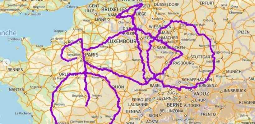
It’s the type of challenge that commands respect, both in terms of the effort it required and the message it gate. Using the track GPS of their routes, a couple of Italian cyclists managed to draw on a map of Europe a bike giant that spans Germany, Austria, Belgium, France, Luxembourg, the Netherlands and Switzerland.
It took three years for Arianna Casiraghi and Daniel Rayneau-Kirkhope to complete this giant course of 7,300 kilometers. Started in 2019, the journey lasted 131 days in cumulative time until this year. To achieve this, the couple quit their jobs as researchers in physical. In order to prepare for this journey that they shared via their account instagramthey have used software to draw a bike which they then associated with Google Maps to create the corresponding route.
Around 960 km wide, this track is considered to be the largest GPS drawing made to date and the largest image drawn solely by bicycle. But for Arianna and Daniel, it’s all about raising awareness about the climate crisis and encourage cycling. ” If people see the image, the message we want to get across is this: remember, you probably have a bike somewhere, and it would be nice if you used it a bit more, rather than a carfor short journeys “, they conclude.