Rain and wind will take turns this week, but it is the cool weather that will particularly mark the spirits. Negative temperatures are even expected.
After a very unstable week marked by showers, storms, hail and even floods in some departments, the next few days are synonymous with cooler weather for three-quarters of the French. This first cold snap that started on Monday is confirmed this Wednesday with new drops in temperatures. In most departments, maximum temperatures will not exceed 15 degrees – the national average forecast by Météo France and La Chaîne Météo. In the mountains, snow is already expected from 1800 meters! Clearly, autumn is here, but winter is not far away either.
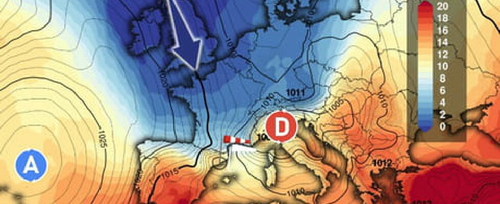
On Wednesday, a cold front arrives from the British Isles via the English Channel and is expected to cross France from north to south. In the morning, the polar air mass begins to rush inland after a passage marked by showers in the north and west of the country. For the rest of the day, only the south-east is spared from the cold rains which will gradually spread over most of the country.

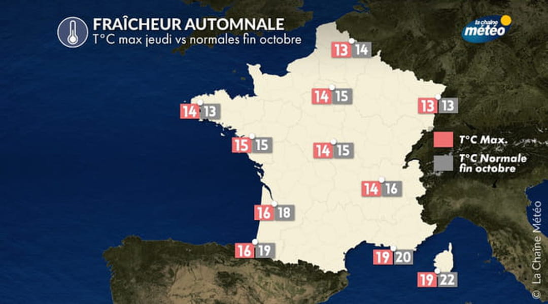
Near the Mediterranean coast, the wind will blow very strongly this week from Thursday. The mistral and the tramontane block the arrival of rain, but gusts of up to 130 kilometers per hour are expected. As for the temperature, the coolness is starting to set in, from Hauts-de-France to the Auvergne region, the thermometer will not exceed 20°C while in the south-east quarter the heat will still be summery, between 23 and 26°C, and 28°C in Corsica.
Thursday is expected to be one of the coldest days of the week. In the north and south, temperatures will drop significantly, -10°C in the south and -5°C in the north compared to the day before! Brief thunderstorms and showers are expected around the Île-de-France region and in the east, towards Strasbourg. The cool weather will mix with the humidity in the northern half of the country, which will not help matters. In the south, it is the wind that will bring coolness. Snow is also expected in the Alps and the Pyrenees from 1800 meters.
In the following days, temperatures will continue to drop, with a peak in coolness expected between Friday and Saturday. The Weather Channel announces the arrival of the first white frosts in the west and central regions, while in the Loire Valley and Champagne, the thermometer could show negative temperatures on the night of Friday to Saturday. With 10 to 15°C less than at the beginning of the week, the days ahead are expected to be particularly gloomy. The heat wave that France experienced in September 2023 is a long way off.
