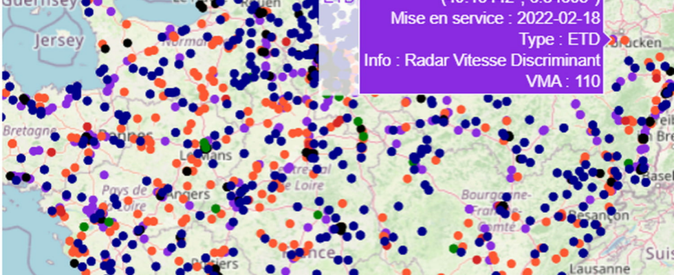
An updated map of all fixed speed cameras posted on our roads is now online and accessible to everyone.
End of the scrappage bonus, ecological bonus slashed, increase in the number of speed cameras, new offenses included in the Highway Code, increase in motorway prices… There is enough bad news at the moment not to say when there is a good one. And when it comes to speed cameras, motorists are immediately very receptive. Before moving to 2025, the number of active radars in France is estimated at around 3,600, most often to detect speeding but also to control red light crossings, while soon awaiting safety distances, the port of the seat belt and the use of the telephone while driving.
Problem: information from the Ministry of the Interior and Road Safety has been limited to the strict minimum for several years. Often obsolete, the data did not reflect the reality on the ground, particularly for what interests the average driver most: the position of the radars. Surprise, the government recently published a file, according to an indiscretion revealed by L’Argus, which lists the 3,268 fixed radars currently deployed in the territory.
Type of device, date of installation, maximum authorized speed in force and above all GPS coordinates of the radar are available online for everyone! This information is grouped on the map below. You will find its location, the type of radar installed, the maximum speed authorized in this sector (for example, VMA 110 = maximum authorized speed: 110 km/h)… You can zoom in on a department or a dedicated zone with the “+” button located at the top right of the map.
Credit: Kévin Cartelier / Data Analyst
All this information is also available on the official government website Data.gouv.fr. Just click on this address: https://www.data.gouv.fr/fr/reuses/radars-en-france/. The government site displays a dashboard allowing you to visualize the implementation of radars according to their type (turret radars, urban radars, section radars, red light radars, etc.) – with the evolution year after year thanks to a timeline – as well as the number of devices per region. On the freshly updated map, it is possible to collect all the information from each radar just by hovering over it with your mouse.
At a time when road traffic offenses have never brought in so much to the state coffers – more than 2 billion euros in 2023 – and therefore cost motorists so much, this file is a gift from heaven for those who know use it. If we generally know the position of the speed cameras on the journeys we take regularly, this is not the case when we venture on unusual roads.
This regularly updated tool can help you prepare your route by locating the location of control devices. Enough to avoid flashes and fines. As long as you don’t come across a mobile radar. Let’s remember, however, that driving at the authorized speed remains the safest way to never receive tickets…
