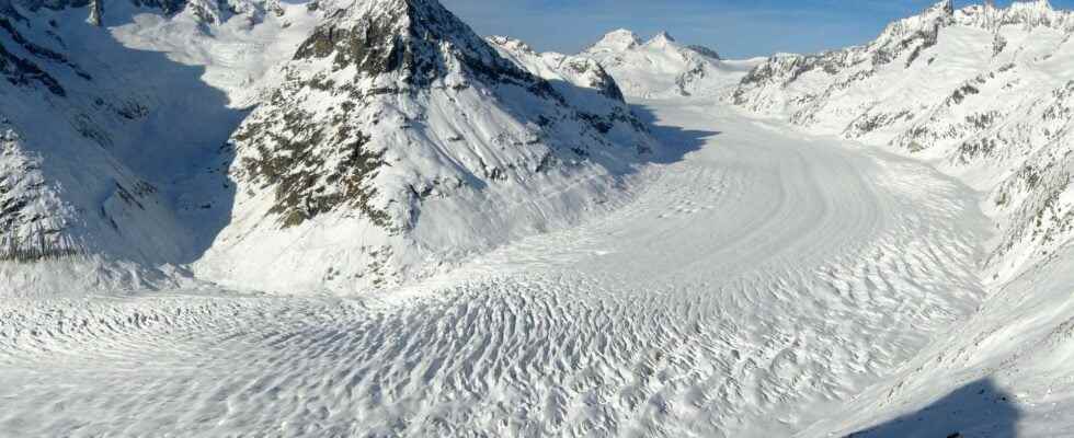
Mountain glaciers are essential for the availability of fresh water on our planet. Knowing the amount of ice stored is necessary to better understand their behavior and better simulate their evolution. Researchers have just established a world atlas of the volume of more than 200,000 glaciers and their flow speed.
You will also be interested
[EN VIDÉO] Ice, a vital white paradise for the Planet Ice is vital to help fight man-made global warming that threatens not only him, but living species as well. Florian Ledoux is ringing an alarm bell on video.
The evolution of glaciers mountains is a major issue: in many countries they serve as reservoirs of drinking water, have an economic impact via tourism in particular and contribute to the rise in sea levels. This evolution was until then little known. We just published a world atlas measuring the flow velocities and thicknesses of more than 200,000 glaciers, as well as a scientific article in the journal Nature Geoscience.
Despite their reduced size (727,000 km²) compared to the combined size of the two large ice caps that are theAntarctic (14 million km²) and Greenland (1.7 million km²), the melting mountain glaciers has contributed to 30% of sea level rise since the 1960s.
Beyond this overall impact, the role of glaciers and their evolution is essential at the local level, thus, their future is a source of growing concern for mountain areas and their foothills.
Little-known glaciers
Despite this fundamental role of glaciers, we have only a very limited idea of the volumes of ice stored in glaciers. This is due in particular to the fact that The glaciers are distributed at all latitudes, in regions that are often difficult to access. Working directly in the field is therefore very complex. Thus, measurements of ice thickness currently only exist over barely more than1% of glaciers on Earth’s surface (outside the Greenland and Antarctic ice caps).
Because of this lack of observations, scientists have developed indirect methods to estimate the amounts of ice on Earth. These methods were first based on the area of glaciers, easily mapped from aerial photos or satellite images.
From the 2000s, methods based on the surface slope of the glacier have emerged, when models digital from the Earth’s surface began to be available on a global scale.
Beyond the slope, the speed at which the glacier flows is even more relevant information for estimating the distribution of ice thickness. Indeed, glaciers flow under the effect of their own weight; an image often used is that of a highly viscous fluid, such as honey. Therefore, mapping the speed at which the glacier is flowing is essential to better estimate the distribution of ice thicknesses and therefore the volume glaciers.
However, field observations of these flow velocities are, again, very limited, but the massive amount of imagery taken from satellites has opened up tremendous opportunities for measuring the flow of all Earth’s glaciers.
Satellites to the rescue
To quantify the flow velocity of all the glaciers in the world, researchers from the Institute of Environmental Geosciences in Grenoble and Dartmouth College (United States) used more than 800,000 pairs of satellite images. These images were acquired between 2017 and 2018 by the Landsat-8 satellites of the Nasa and the European Space Agency’s Sentinel-1 and Sentinel-2 satellites (ESA). This new generation of satellites constitutes a revolution for the observation of glaciers, with images of all emerged land acquired systematically at regular time intervals (from 5 to 16 days). For example, the Sentinel-2A and 2B satellites acquire an image of each point on the earth’s surface every five days, with the possibility of observing objects with a size of a few tens of meters. Thus, between two consecutive images, the displacement of a glacier is clearly visible in these images.
Several million hours of calculations on the servers from the University of Grenoble Alpes were necessary for us to assemble a unique atlas of the flow of more than 200,000 glaciers around the Earth.
One of the main contributions of this atlas is the coverage of a great diversity of glaciers, ranging from small Andean glaciers only a few kilometers long, to ice caps in the Canadian Arctic or ice fields in Patagonia. , flowing over areas of several thousand square kilometres. These maps thus make it possible to better understand the way in which glaciers flow.
They illustrate the wide variety of behaviors, with glaciers flowing at a few tens of meters per year (like some glaciers in the Alps), and others whose flow speeds reach several kilometers in a single year (for example some Patagonian glaciers). This database unique allows researchers to better constrain the representation of glaciers in models, and thus better estimate their future evolution.
Furthermore, it is this exhaustive atlas of ice flow velocities that has enabled our team to re-estimate the mapping of the distribution of ice thickness and therefore the volume of glaciers. Indeed, by combining information on the surface flow velocity of glaciers with that of the surface slope, in a numerical model simulating the way in which the ice slides and deforms, we have thus proposed a new representation of the glacier geometry.
In multiple regions, the results of this work provide estimates that are significantly different from previous ones, with important consequences on the availability of potable water for consumption, but also for example for agriculture or hydroelectric production. For example, in the basins of the Indus and Chenab, located in the Himalayas, the water stocks contained by the glaciers would be 30% greater than previous studies. Conversely, in the tropical Andes of South America, the new estimates are more alarming, with glacial water stocks almost a quarter lower, thus increasing the pressure on water resources in these regions.
Videos representing the ice thicknesses of the Barpu and Chogo glaciers in the Karakoram (Himalayas). © IGE-CNRS, Dartmouth CollegeGoogle Earth
Beyond a new inventory of the volume of glaciers, this study makes it possible to redefine the three-dimensional geometry of glaciers with greater precision and in accordance with the mechanics of ice flow. This is crucial to better simulate the future evolution of glaciers and, in particular, to identify the sectors where the glaciers will disappear and those where they should persist, at least until the end of the century, although in markedly more reduced.
This study marks a major improvement in the quantification the distribution of ice thickness. However, the estimation of the volume of glaciers remains subject to significant uncertainties, especially in regions of the world where populations are highly dependent on glaciers. To minimize these uncertainties and improve the results in these regions, it is essential to be able to have some field observations in order to better constrain the calibration of the modelization thickness. This calibration step is all the more important as glaciers are varied objects, subject to multiple environmental conditions. Consequently, using in models behavior laws established on the basis of observations made on a few glaciers is necessarily a source of uncertainty.![]()
Interested in what you just read?