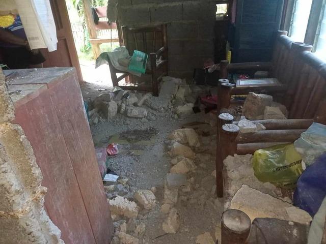
In the statement made by the US Geological Survey (USGS), a 7.6 magnitude earthquake occurred yesterday off Mindanao Island in the south of the Philippines. The earthquake occurred at 22.37 local time, at a depth of 32.8 km.
In the statement made by the Philippine Institute of Volcanology and Seismology (Phivolcs), a tsunami warning was issued after the earthquake, and it was stated that the tsunami could hit the Philippines until midnight local time. It was also stated that the tsunami could hit the west coast of Japan today.
THE DAMAGE WAS REVEALED AT DARK
In the statement made by the local government of the Hinatuan region on the island of Mindanao, it was announced that damage assessment studies in the region are continuing.

Photos published by the local government showed the damage that occurred after the 7.6 magnitude earthquake.
In the photographs, it was seen that some houses were destroyed, roofs collapsed and minor damage occurred.

AN EARTHQUAKE TOO TODAY! THIS TIME 7.0
The US Geological Survey (USGS) announced that a magnitude 7 earthquake was recorded off the eastern coast of Mindanao Island.
No tsunami warning was issued after the earthquake, which occurred at a depth of approximately 10 kilometers underground.
The Philippines, one of the countries with the most seismic movements in the world, is located in the Pacific Seismic Zone, also known as the “Ring of Fire”.


(IHA-DHA-AA)

