We made maps of the data and electricity transmission networks cruising at the bottom of the Baltic Sea, as well as the oil tankers sailing at sea.
The summit on the security of the Baltic Sea region started in Helsinki on Tuesday morning. Securing the underwater infrastructure and combating the threat posed by the Russian shadow fleet are the main themes of the meeting. In the background is the sneaky work on electrical and data cables last year.
The summit is hosted by the President of the Republic Alexander Stubb together with the Prime Minister of Estonia Kristen Michalin with the summit, to which the leaders of the NATO countries of the Baltic Sea region have been invited.
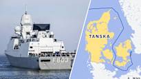
NATO already said last week that it would strengthen surveillance in the Baltic Sea. HNLMS Tromp, the Dutch flagship of NATO’s ship division, sailed through the Danish straits to the Baltic Sea on Sunday.
A Dutch frigate will lead the ship section of NATO’s rapid action force at sea for a year, says the Dutch public broadcasting company NOS. This SNMG1 section is on standby to respond on behalf of the Defense Alliance.
We made maps that help to understand why the Baltic Sea Security Meeting is important.
1. Telecommunication and electrical cables
Data and electricity companies have laid dozens of cables at the bottom of the Baltic Sea. They are well protected on the shore, but vulnerable on the seabed.
These two maps show where the Baltic Sea communication and electricity transmission cables run in the Baltic Sea:
2. Dozens of oil tankers
Dozens of oil tankers sail in the Baltic Sea on any given day. Most of them operate on legal matters.
There are, however, ships that either belong to the so-called Russian shadow fleet or otherwise transport Russian oil to customers. Shadow ships hide their ownership and avoid location.
This map shows how many oil tankers were in the Baltic Sea on Monday 13 January. based on location data:
3. Territorial sea limits
The Baltic Sea, like other sea areas, has regional water areas and international water areas.
The territorial waters near the coast, i.e. the water area of the territorial sea, are the state territory of each coastal state.
The economic zone extends beyond the territorial sea, in the area of which each country has the right to exploit the seabed economically. However, the surface of the economic zone is international sea area.
For example, a Liberian-flagged tanker sailed from Laukaansuu in Russia to the Danish straits over the weekend, avoiding territorial waters.
This map shows territorial sea boundaries in the Baltic Sea:
4. Pipes and cables damaged in recent years
The most famous of the pipeline and cable breaches in the Baltic Sea is the Nordstream 2 gas pipeline rupture that occurred in September 2022.
In October 2023, Newnew Polarbear broke the Balticconnector gas pipeline and damaged communication cables. In November 2024, the data cable between Sweden, Lithuania, Finland and Germany was dismantled.
On Christmas Day 2024, the Eagle S tanker is suspected of breaking the Estlink electricity cable between Finland and Estonia and four data cables in the Gulf of Finland.
