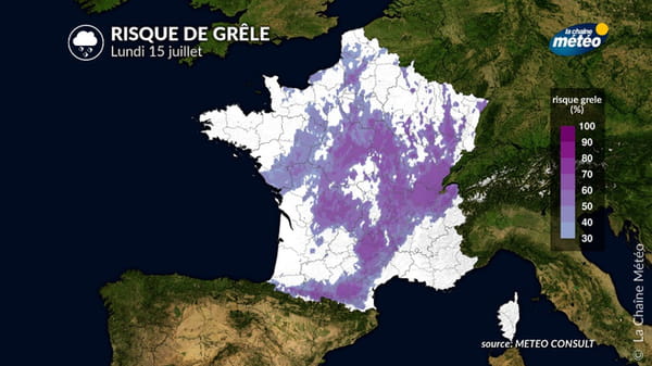
This Monday, 24 departments were placed on orange alert due to the risk of storms.
The weather is still playing tricks. This Monday, the orange alert level for “storms” concerns 24 departments according to Meteo France. They are mainly located in the east of the country. Eight departments have been added to those of the day before. Ain, Allier, Ardennes, Haute-Loire, Marne, Loire, Puy-de-Dôme and Rhône join Aube, Côte d’Or, Doubs, Jura, Haute-Marne, Meurthe-et-Moselle, Meuse, Moselle, Nièvre, Bas-Rhin, Haut-Rhin, Haute-Saône, Saône-et-Loire, Vosges, Yonne and Territoire de Belfort. Yonne and Ain in particular were already hit by violent storms last week. Homes were left without electricity and damage was also noted on some houses.
Meteo France announced that the north-east of the country and Auvergne-Rhône-Alpes will be affected this afternoon and this evening by an “intense stormy deterioration”. This morning, rain fell on Brittany. This rainy disturbance will stretch into the afternoon towards Hauts-de-France and the Paris region.
The strong storms that will hit the east of the country could be accompanied by hail, wind gusts of nearly 100 km/h and intense precipitation. “Punctual intense” storms are also expected in the neighboring departments, at yellow alert level.

“It is this Monday evening between 6 p.m. and 10 p.m. that the peak intensity of this deterioration will be reached,” the Weather Channel. Following these weather conditions, the SNCF even called in the Auvergne-Rhône-Alpes region to carefully check the circulation of trains before their departure, or even to postpone journeys.
The return to calm should arrive during the night from Monday to Tuesday. Tomorrow, the weather will improve but will remain cloudy. Fine days are expected from Wednesday to Friday. The heat should thus rise a notch until the weekend, which could, for its part, mark the return of a disturbance over a large part of the country.
