full screen
Next
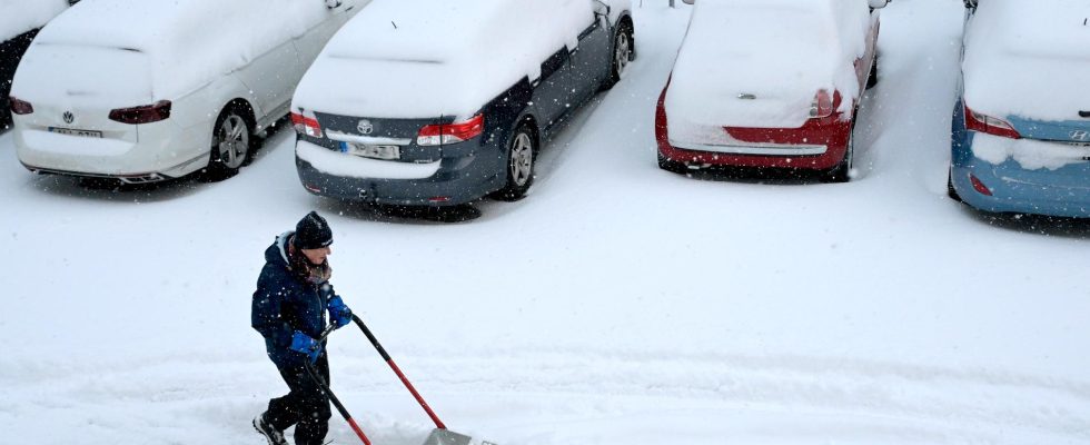
On the night of Thursday, a lot of snow fell over many parts of the country. The picture shows Solna, Stockholm county.
1 / 2Photo: Janerik Henriksson/TT
Right now, parts of Sweden are affected by snow cannons. It is a weather phenomenon that meteorologists have more difficulty predicting in their forecasts than, for example, low pressure.
– More manual handling is required, says Therese Fougman, meteorologist at SMHI.
The forecast shows overcast weather, but the snow is pouring down outside. If that happens, a snow cannon may be the cause.
Snow cannons are heavy snow flurries that are more difficult to predict in weather forecasts than both low pressure and frontal precipitation, i.e. precipitation that forms when different air masses meet.
A contributing factor is that meteorologists’ weather radars can miss the snow cannons, as they are often narrower. In addition, several different factors interact to create them.
But even when meteorologists know that a snow cannon is coming, it can be difficult to predict exactly where the snow will fall. A slight change in wind direction means that the snowfall can end up in a different place than expected.
– A difficulty is when very narrow lanes are formed with snow flurries. It is not infrequent that the snow flurries appear on the radar all the way from St. Petersburg, swirl over the Gulf of Finland and the northern Baltic Sea and then retreat to the Swedish coast. Then it depends on exactly where the wind is to know where the snow falls, says Therese Fougman.
Snow cannons along the east coast
The snow that caused major traffic jams on the E22 in Skåne is not due to a snow cannon, but is more connected to a low pressure that passed south of Sweden.
On the other hand, the abundant snowfall in Eastern Svealand and down along the coast of Småland, Öland, Gotland and easternmost Blekinge can be explained by snow cannons.
– There are snow cannons, even if they are not isolated narrow strips but quite widespread, says Therese Fougman.
More snow cannons in the north
Snow cannons are caused by dry and cold air sweeping over an ice-free sea. Nowadays, the sea ice is smaller due to climate change. But whether the warmer sea leads to more snow cannons in the future is unclear.
– We have tried to look at it, but the models are not very good at describing snow cannons, says Anna Rutgersson, professor of meteorology at Uppsala University.
What is more certain, however, is that the snow cannons will occur in new places.
– If you have ice on the sea, there will be no snow cannons, but if there is a smaller ice sheet, you can imagine that there will be snow cannons in places where they have not occurred before.
One example is that if the Gulf of Bothnia has more open sea, the snow cannons can be moved further north in Sweden. To the south, however, there may be fewer snow cannons if it is warmer and less snow due to global warming, according to Anna Rutgersson.
FACT This is how a snow cannon is formed
Dry and cold air sweeping over an ice-free water surface can capture large amounts of water vapor as the air is heated by the water and there is strong evaporation (warm air can carry more water molecules than cold air).
It can create long bands of powerful snow flurries, which in a short time can produce meter-thick snow covers – a phenomenon popularly known as snow cannons.
The temperature difference should be approximately 15 degrees between the water and the air (measured at an altitude of 1,500 metres).
An example of a heavy snow cannon is the snowstorm that hit Gävle on 4–7 December 1998, when the snow cover grew from 1 to 131 centimeters.
Source: Anna Rutgersson, professor of meteorology at Uppsala University
Read more