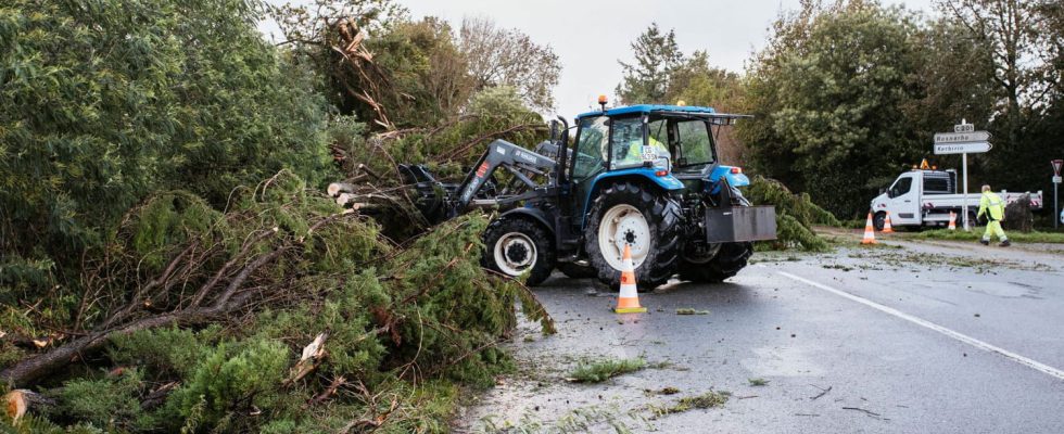
A new storm is expected to arrive on Saturday November 4 in the west of France. The “activity” of the Domingos depression should, however, be “well below” that of the Ciaran storm, according to Météo France.
The western side of the country is not done with bad weather. After being heavily affected by storm Ciaran, the west of France is preparing to face depression Domingos, which should arrive on Saturday November 4 according to Météo France. In a bulletin published Thursday evening on his website, the meteorological institution mentions “attention to Vendée and Loire-Atlantique on the one hand and the coastal departments of the Channel on the other”, as well as “winds which can reach 100 km/h inland”. Météo France indicates, however, that there is “still uncertainty” about this depression.
The French observatory for tornadoes and violent storms Keraunos adds for its part X that gusts close to 130 km/h are expected on the western coasts, also evoking “violent winds on the reliefs and in Corsica”. Keraunos also reports “sustained and abundant rain” forecast for Saturday in the west, “and in particular on the reliefs exposed to the west”. In a vigilance bulletin published this Friday morning, Météo France specifies that the Domingos depression “will bring a new gale to the north of the country”.
For the moment, only the Pas-de-Calais department will be on orange alert on Saturday, for the risk of flooding. But Météo France warns that “a move towards orange ‘wind’ vigilance is very likely in certain departments on the Atlantic coast (around Vendée/Poitou Charentes in particular)”. Saturday evening and during the following night, a transition to orange vigilance “waves-submersion” “is not excluded in the departments of Bouches-du-Rhône, Var, Alpes-Maritimes and Corse-du-Sud, due to the strong waves from the southwest sector expected,” the meteorological service further specifies. “This episode could be stronger than the one ending this Friday,” warns Météo France.
A “strong impact” expected, according to Agnès Pannier-Runacher
Météo France mentions in its situation update Thursday evening an “activity” of the Dominguos depression “well below” the Ciaran storm. “Nothing to do with Ciaran in terms of winds,” assures the Keraunos observatory. But according to the Minister of Energy Transition, this new climatic episode is “likely to also have a strong impact”, due to the damage caused by Ciaran, reports BFMTV.
“Some of the trees will have been weakened, half uprooted, some of the roofs will have been weakened and therefore we can expect to have a second phase with an impact on the networks and on the buildings,” declared Agnès Pannier-Runacher Thursday, during a press conference with Enedis, the manager of the French electricity network. The minister assured that state services are making sure “to now take all measures to secure buildings, covering, securing roads, cutting, to allow the roads to be fully accessible” before the planned arrival of this “second storm episode”.
