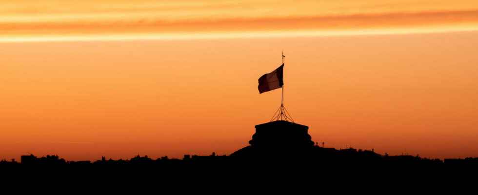
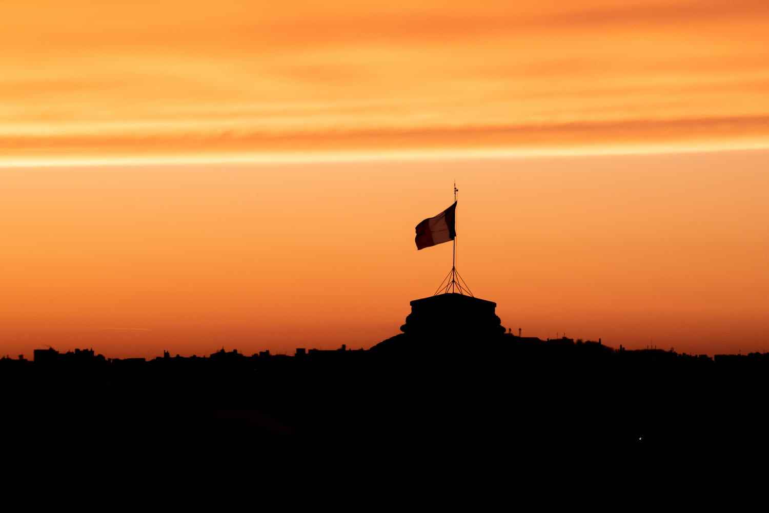
SAHARA SAND. On Monday April 11, the French sky suddenly turned yellow, and a thin layer of ocher dust covered the cars. This is the new wave of sand coming from the Sahara, almost a month after the one that passed over our heads in March.
Rebel! On April 10, a month after the wave in March, sand from the Sahara flew up and covered the sky in France with an orange hue with deposits due to the passage of precipitation. First very visible in the Pyrenees where the ocher dust crossed the mountainous relief, the phenomenon will gradually go up France in the coming days, first towards the “West of the Great East”, according to the experts. The concentration will strengthen this April 12, until the cloud of dust concerns “all of France”, in particular on a band going from “Occitanie to Normandy and Hauts-de-France”, explains Météo -France. Last month, the Pyrénées-Atlantiques were the most affected territory, according to the Central Air Quality Monitoring Laboratory. This time again, the meteorological phenomenon should leave traces on the cars with a thin layer of dust, but also in the air with radioactive particles. How to explain this strange phenomenon?
The orange sky that the French can observe around April 11 and 12 is actually linked to an upwelling of sand from the Sahara. This meteorological phenomenon, while impressive, is rather common: Weather Paris indicates that it occurs several times a year, or even every season depending on the period. It should be noted that the intensity of the phenomenon of last March is linked to the period, winter being its favorite season since the atmospheric circulation there takes on a very marked meridian component. This time it should be less intense, but similar to the previous ones. In France and Spain, it even has nicknames: sirocco and calima respectively. It takes place when an Atlantic depression dips south and positions itself over the Iberian Peninsula, raising a strong warm wind from south to southeast over the Maghreb. If the wind is sufficiently persistent between this sector and France, it produces a “pump phenomenon”: this dust then reaches our territory directly and can lead to precipitation.
It is at this time that we observe deposits on the ground and a modification of the colors of the sky. This time, the depression is particularly important: a depression off the Atlantic associated with a thalweg induces winds from the south sector bringing back desert dust emitted from the north of the Maghreb, details Meteo France. For information, a thalweg corresponds to the line formed by the points having the lowest altitude, either in a valley or in the bed of a watercourse.
The strength of the wind, the geographical extent and the duration of the phenomenon make it an event, despite the frequency of this type of event in France. This south-to-southeast flow, dynamic enough to advect sand dust to our lands, first spread large amounts of sand dust to southwestern Spain on April 7. However, according to David Minguet, forecaster at MétéoFrance: “This episode will be less intense than the previous one. This Monday, April 11, there is already some desert dust, in fairly low concentration, arriving from the Pyrenees, in the south-east” ( comments reported by France 3). You are reassured: this time, the sand of the desert will not be so tenacious to encrust your car.
When was France affected by these deposits? On the evening of April 9, a cloudy episode laden with dust from the Sahara broke out in France. These sandy dusts currently extend to the north. David Minguet also clarified that these concentrations will “reinforce this Tuesday, April 12”, and that the cloud will spread over the whole of France, “particularly with a band which spreads from north to south”. Higher concentrations are expected to remain in the south-west, before flowing out through the German borders.
This April 12, but especially on April 13, Parisians will observe dry and wet deposits in the streets of the capital, a little after the French regions further south which were affected from the 10th. Guillaume Séchet, from Météo Villes precisely explained to the newspaper Le Parisien that the massive phenomenon, when it reaches Paris, will make its sky “very milky, a little phosphorescent, before clearing under the effect of the North-East winds”. Note that in particular in Paris, the temperatures are higher! Compared to the 12 degrees that Parisians suffered in the first week of April, the 21 degrees brought by this cloud will change the situation.
Significant dust concentrations in the west, particularly in the South-West, which was first affected on Saturday April 9, moved towards Aquitaine. It is expected that on Wednesday April 13, the cloud will “shift slightly towards the east of the country” with a “strengthening of concentrations” expected in “West Occitania”, specifies MétéoFrance. The last time, in March, the experts had noted a deterioration in the Atmo clues air quality in the departments of the region. The prefect of Pyrénées-Atlantiques had even triggered the fine particle pollution alert procedure for these two days.
“It seems that, compelled by some marvelous lamp, a genie from the Orient kidnapped him during one of the thousand nights, and stole him from the countries of the sun to hide him in those of the fog with the loves of a beautiful prince.” Alfred de Vigny#Sand #Sahara #Storm pic.twitter.com/YVFDN4EIXU
— Chambord Castle (@domainechambord) March 15, 2022
The peak will be reached in the northern half of France on Wednesday, April 13… Day when all the French regions will be overflown by Saharan sand and when deposits were visible on the bodies of vehicles. The return to normal should arrive on Thursday April 14, when the cloud will begin to evacuate via the southeast axis, with a change in the meteorological situation via a “ridge” which will be set up on the “Atlantic facade” .
But, the dust that this phenomenon propagates being harmful (because it contributes to the rise in the level of fine particles), it is recommended to keep a mask when traveling outdoors, especially for people with respiratory problems. . But is there radioactivity in this phenomenon? In fact, experts agree that the fallout from nuclear tests carried out in the 1960s left a lasting mark on the Sahara desert, as the Institute for Radiation Protection and Nuclear Safety reminds us. These fallouts come from a hundred atmospheric tests carried out by several great powers: in the final score, the USSR and the United States are neck and neck with 219 shots, then comes the United Kingdom with 23 shots, China with 22 and France with only 4 in the Sahara (but 46 in Polynesia).
The sand indeed contains cesium 137, a radioactive element which has a half-life of 30 years and which can therefore act on these particles. However, radioactivity specialists want to be reassuring since the phenomenon had already occurred in February 2021, without major consequences on air quality. Indeed, if, during this month of February, the activity concentrations of cesium 137 had been higher than the average of the activities measured in February 2019 and 2020 (measurements taken by IRSN as part of its mission to monitor the radioactivity of the air), the concentration of cesium 137 present in the fine particles of Saharan sands was “in February 2021 extremely low in the atmosphere and at ground level” recalls Jean-Christophe Gariel, deputy director general in charge of the health- environment at IRSN (comments reported by the Parisian). The health impact of these meteorological episodes is therefore considered negligible by IRSN. If health risks exist, they are no worse than those of classic air pollution: in the same way as in March, Météo-France did not communicate an operational color forecast, because this phenomenon will not have normally no real impact on the safety of people.