The depression coming from the Atlantic promises rainy days for a while. The forecasts indicate that it will last with even one day at risk.
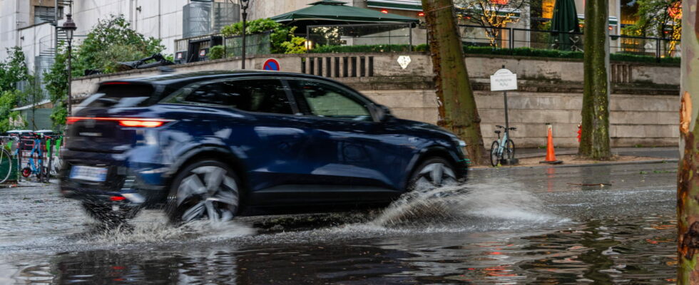
Monday served as a transition between the stormy trend at the end of the weekend and the rainy trend which will hit the entire country until at least the next weekend. Sunday 12 was even the “most lightning-hit day of 2024”, according to Météo France. This week, the rains will spread throughout the country and could cause further damage in towns still affected by the latest floods.
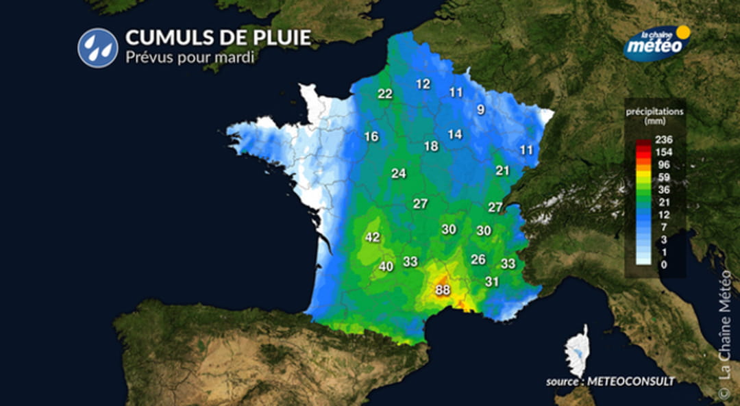
This Tuesday is considered a risky day, the weather is heavy due to still seasonal temperatures and heavy rains which are becoming widespread. Calvados remains on orange alert, risk of flooding, according to Meteo France. The disturbance also reaches the Pyrenees, but it is the south of the Massif Central which should be most affected by the precipitation, up to 90 mm in Aurillac and Montpellier. The wind will blow on the Channel and Atlantic coasts but the precipitation will be less heavy than the previous two days.
Temperatures are decreasing drastically throughout the country except in Corsica and Strasbourg, where depressions have not yet occurred. It should not be more than 18°C or 20°C until mid-week, except in a few cities like Bastia, Lille, Lyon, Montpellier, Nice, Perpignan. The inhabitants of the German border and the Isle of Beauty are luckier, it will still be warm and sunny there, The Weather Channel forecast temperatures around 26°C in these two locations.
On Wednesday, showers continue over three quarters of the country and reach the regions still spared. Temperatures continue to stagnate between 9 and 15°C over a large part of the country and up to 18°C in Corsica and the Mediterranean basin for the morning, and should hardly climb above 20°C. The storms will concentrate around the Gironde and the south-east of the country, and it will be necessary to monitor the waterways.
There will be little improvement on Thursday and Friday, stormy showers will return to the entire country, only the Isle of Beauty still seems to be spared. It is in the afternoon that things become complicated, with the rain continuing to fall, the risk of flooding could well reach the southern departments which are having difficulty recovering from the bad weather at the end of April.
For Saturday and Sunday, the news is not good. “The cumulus clouds will quickly gain momentum. […] Showers will occur almost everywhere,” announces The Weather Channel. Worse: “Little development to be expected for Sunday, with showers which will remain current. They will start preferentially in the afternoon, occasionally taking on a stormy character. The Mediterranean regions should remain sheltered, even if the The sky is not always blue.