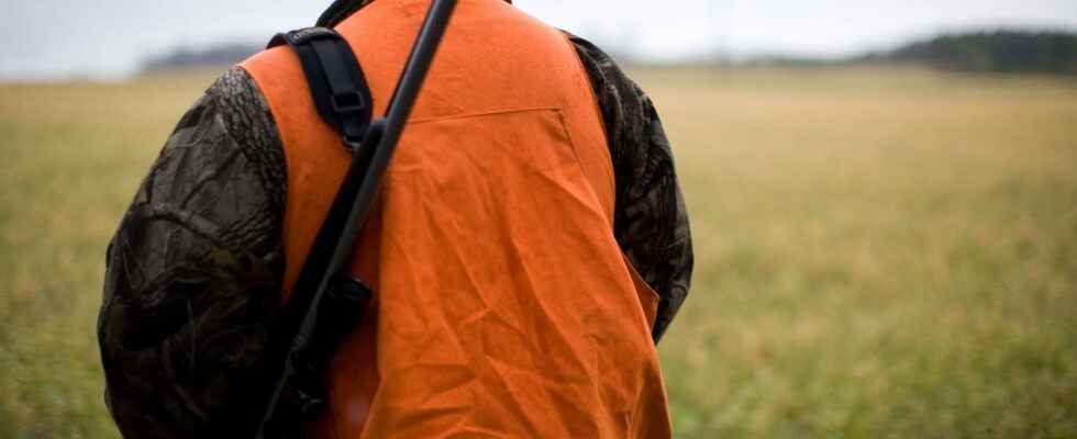
The Government has just proposed several measures to limit hunting accidents, in particular with Suricate, an application allowing hunters to geolocate themselves to warn walkers. A difficult solution to implement that does not satisfy anyone.
It is a public debate that divides and returns each autumn, at the opening of the hunting season in France: should hunting be banned on Sundays in order to leave the field open to walkers? Indeed, with the hunting accidents that have been publicized in recent years, walkers feel less and less safe when they walk in the countryside, in particular the woods and forests, areas that are very popular with hunters. One Ifop poll reveals that only 30% of them today say they feel safe during a walk in nature, compared to 46% in 2009. In the end, it is no less than 80 % of French people who want hunting to be banned on Sundays, a request strongly supported by the Europe Écologie-Les Verts party and animal protection associations. The Government therefore had to look into the subject and Bérangère Couillard, the Secretary of State in charge of Ecology, presented this Monday, January 9 his plan to better secure the practice of hunting and reduce the number of accidents – the objective set is to achieve “zero accidents” – without prohibiting its practice on weekends. One of his proposals consists of an application so that hunters can report their position in real time and thus warn walkers – definitely, applications seem to be, with the famous toll-free numbers, the miracle solution to each problem encountered by the Government, with their known effectiveness.
Meerkat: the miracle application of the Government
As a reminder, the French Office for Biodiversity recorded 90 accidents over the period 2021-2022, including 8 fatalities. Among them, 2 victims were not hunters. There were also 6 serious hunting accidents, i.e. resulting in more than 10 days of incapacity for work, for walkers and 36 for hunters, as well as 17 and 26 “light” accidents affecting respectively walkers and the hunters. Hence the idea of an application to avoid being near lines of sight. Note that many apps of this kind have already been launched and have had fairly mixed success due to their many limitations. We are thinking in particular of Protect Hund, LandShare, Chasse Info or Chasse Eco.
The government’s new mobile app already exists, and it’s called Meerkat. Offered by the Ministry of Sports since 2014 on Android and iOS, it allows you to report problems encountered during your sports activities and nature leisure activities, such as a markup error, a pollution problem, an incorrect sign, a conflict of use, faulty equipment, etc. It is used in particular by hikers, cyclists and fishermen. Once the information has been entered and reported, it is passed on to the 730 administrators and 75 coordinators, from sports federations, local authorities, State services and managers of natural areas, who form this network. For the fall of 2023, the Government therefore wishes to carry out a major update in order to ensure geolocated and real-time monitoring of hunters which will be compulsory, but only for the organizers of collective hunting, such as hunts.
On paper, using Meerkat is pretty straightforward. Once the application is installed on the smartphone, you must report the location of the problem by validating its GPS coordinates, then fill in several pieces of information, indicating in particular the activity concerned (rowing, horse riding, climbing, etc.), the type of problem and its extent. . Finally, you must enter your email address, describe in a few words the problem encountered and add a photo. The information is then transmitted to the Meerkat network, which is responsible for resolving reported anomalies. With the new functions that the Government intends to add, hunters will be able to share their geolocation during their hunting sessions, and walkers will be able to log in to find out which areas to avoid in order to adjust the route of their walk. Finally, this is the theoretical version, because things may not turn out that way…
Walkers hunters application: a smokescreen difficult to set up
This is indeed the whole limitation of the project: for the Government’s plan to work, all hunters would have to spontaneously provide GPS coordinates – especially since this is only compulsory for collective practices – and that all walkers remember to look at the application regularly during their walk. Suffice to say that it is not ready to happen. And that’s without counting on the fact that not everyone is always comfortable with technology, especially the elderly, who may find it difficult to consult and even more difficult to use the application… let’s not even talk about technical problems since Suricate is extremely criticized by its current users – the application has a rating of 2.5 on Android… – who complain about approximate geolocation, slowness, bugs (the app closes on its own) or reports that are still not validated six months later.
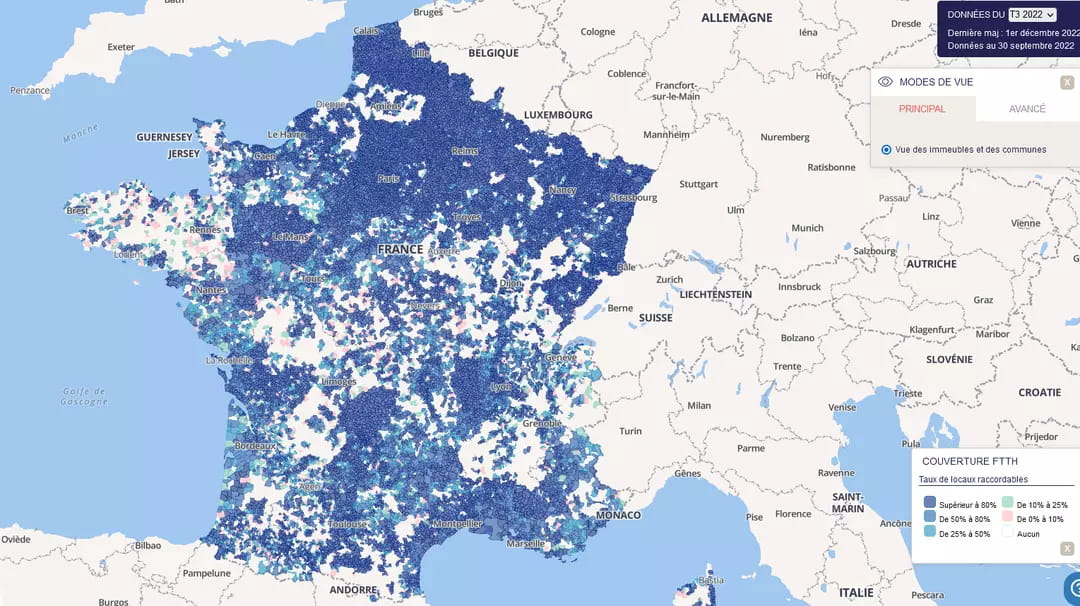
Another somewhat problematic parameter to take into consideration: the absence of a network. Indeed, it is sometimes difficult to find them in the forest or in the countryside (the famous white areas), as shown by the latest maps published by Arcep – certain regions, such as Brittany or the Rhône-Alpes, are very lagging behind in relation to Ile-de-France and the Grand-Est. Moreover, Meerkat users complain about this recurring problem: without a network, it is impossible to activate geolocation and therefore to make a report, since there is no field or map to manually enter their position…
Walkers hunters application: a solution that does not satisfy anyone
It is not surprising that this measure is greeted with great skepticism – even total incomprehension – by hunters and anti-hunters alike. At the microphone of franceinfoWilly Schraen, president of the National Federation of Hunters, finds the idea “ridiculous”. For him, “professional” walkers (mountain bikers, hikers, athletes, etc.) already use this kind of application. For Sunday walkers, “it is rather necessary to make an application where the territories without hunting are mapped“, which would solve the problem of white areas. Other hunters fear the excesses that this type of application could cause, in particular with the arrival of activists with the aim of disrupting the course of their activity.
On the side of the environmentalist party, the Government’s announcement aroused an outcry and was even described as a “joke” by Sandrine Rousseau. Guillaume Gontard, Secretary of State to the Minister for Ecological Transition and Territorial Cohesion in charge of Ecology, believes that “everyone knows the random nature of this type of application which gives a false idea of security and is ultimately dangerous. Finally, the idea of the miracle application does not satisfy either side – it gives them at least one point on which they can agree – and looks more like a smokescreen intended to reassure the population…