Usually used as a geographical tool firmly rooted in reality, maps also populate the world of the imaginary. This is particularly the case of Middle-earth, imagined by Tolkien, which is today the subject of many very detailed cartographic representations.
You will also be interested
[EN VIDÉO] The 3D map of the history of the Universe One of the most important advances of the last decade in terms of cosmological observation: the most complete 3D map of the universe ever produced!
If maps are one of the tools used to represent the real world, they are also very present in the realm of the imagination to illustrate the worlds in which the characters of role-playing games, video games or fantastic stories. In fictional literature, one of the best known and most mapped universes is certainly that of the Lord of the Rings by JRR Tolkien.
Detailed geography created from scratch
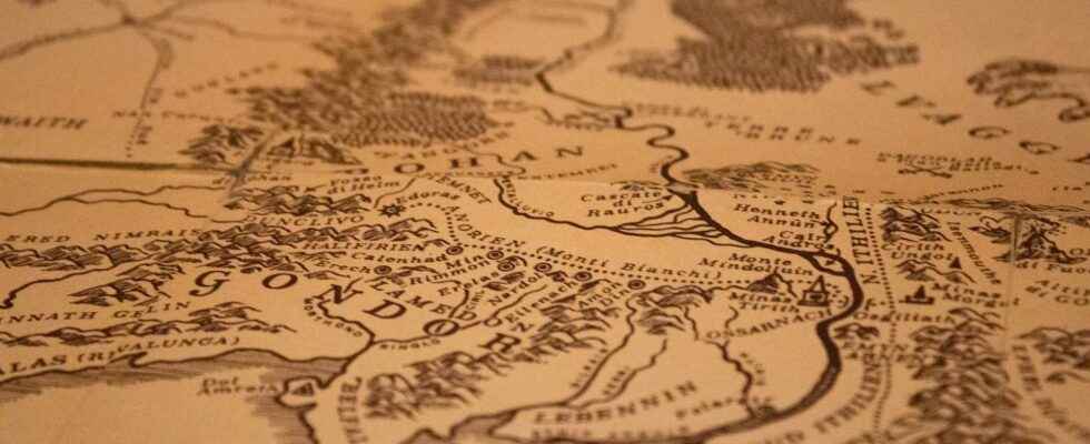
The story takes place in Middle-earth, a world created from scratch by the author. It might be anecdotal, but the strength of the story is certainly linked to the fact that Tolkien managed to build a coherent universe, realistic and meticulously described. ” I began, wisely, with a map, to which I subordinated the story », explained Tolkien. The Lord of the Rings thus originally includes three maps, a general map, one of the Shire, and one representing Gondor, Rohan and Mordor. They were drawn by Christopher Tolkien, the author’s son, from sketches left by his father.
The interest of these cards is obvious. In addition to helping the author to construct a coherent fictional story concerning places and distances, they help the reader to find his bearings in space during the story and thus give depth to the story and a feeling of realism.
GIS tools at the service of the imagination
Based on these original maps as well as on the geographical details given throughout the story, many enthusiasts have had fun creating new maps, each more precise than the other thanks to modern mapping tools, including GIS (Geographic Information System). These tools are usually used to build all types of maps from real data. However, nothing prevents the introduction of data drawn from a fictional universe. Many projects also provide GIS data sets that can be opened in a software like QGIS (open and free).
This is how Middle-earth now has his digital model of elevation where the names of the places are represented, but also the topography, with curves of levels, lakes and forests, ruins, roads, and strongholds…
GIS data thus makes it possible to have fun creating interactive maps or views of space that are more real than nature! It is even quite possible to follow Frodo’s journey on Google map and calculate the travel time on foot, by boat or by back of eagle between different points.
When the real and the imagination mix cleverly to make us dream a little more!
Interested in what you just read?