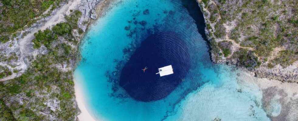
Dolines, geological structures typical of our karstic regions, have been discovered at a depth of more than 4,000 meters, at the foot of the Bahamas carbonate platform.
You will also be interested
[EN VIDÉO] Blue, or the mysteries of the blue of the ocean At first contemplative, Elisabeth Lauwerys’ film takes us into the blue of the ocean to admire its marvels but also its mysteries. In stunning scenes, we glimpse the hunting strategy of barracudas and the adventures of the loggerhead sea turtle. © Elisabeth Lauwerys, Oceans Below
Among the typical geological formations of our karst landscapeswe can cite the sinkholes. These circular-shaped depressions observed on the plateaus limestoneparticularly in the Jura mountains or in the Pyreneesresult from the dissolution of rocks by runoff water, made acids by vegetation. It is therefore a process of chemical erosion which gradually eats away at the limestone rock in depth and leads to a collapse when the cavities thus created come close to the surface. It follows the formation of holes whose diameter can go up to several hundred meters.
Sinkholes also in the marine environment
But this type of training is not specific to the emerged domain. Sinkholes have long been known at sea, such as the famous Blue Holes of the Bahamas. Located at shallow depth, usually less than 100 meters below the surface, these “blue holes” are however very deep. Dean’s Blue Hole sinks over more than 200 meters. These sinkholes, now underwater, were nevertheless formedair free, while the level of the oceans was much lower during the last ice age.
Recently, however, scientists have discovered giant sinkholes in a completely different environment: on the bottom of the abyssal plain. These structures, located more than 4,500 meters underwater, were observed at the foot of the Bahamas carbonate platform. From seismic reflection data acquired between 2016 and 2017 thus updated 29 circular holes, ranging from 255 to 1,819 meters in diameter and from 30 to 185 meters deep. These dimensions, as well as the depth of these sinkholes, challenged the scientists of the Caramba-2 oceanographic mission (Carbonate Ramp Bahamas Re-sedimentation).
Corrosive fluids could contribute to the generation of tsunamis
In an article published in the journal Geomorphology, scientists from the University of Bordeaux believe that these structures were formed by the dissolution of carbonates from the foot of the platform by corrosive fluids such as brine. These fluids, which have a density greater than that of seawater, would circulate along the base of the platform, trapped by the immense escarpment of Blake Bahama which rises more than 4,500 meters above the oceanic plain of San Salvador. The depressions are indeed aligned along the escarpment and are more specifically located at the intersection with large fracture zones.
The scientists assume that these faults, which cut through the carbonate platform, serve as conduits for these fluids resulting from the dissolution of the evaporitic rocks (salts) present within the platform. The high density of these fluids causes them to migrate towards the depths to the foot of the escarpment where they are then trapped and will begin to dissolve the carbonates, preferentially along the faults which bring them there. The morphology of the foot of the Blake Bahama escarpment would thus be associated with this process of dissolution, which could in particular lead to collapses capable of generating tsunamis.
This study therefore reveals the scale of fluid circulation at the level of carbonate platforms and helps to understand their distribution in this type of deep environment. The more in-depth study of these structures of dissolution and collapse at great depth could make it possible to better understand and prevent the gravitational destabilizations potentially at the origin of tsunamis. Scientists also speculate that the brine exhaust at the bottom of these sinkholes could support the existence ofecosystems based on chemosynthesis.
Interested in what you just read?
