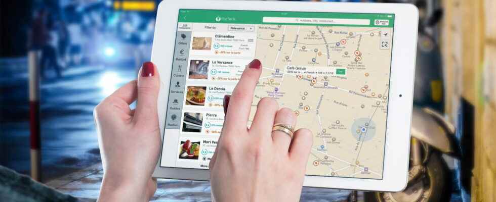
Taking advantage of a complete overhaul, Apple Plans arrives today in France in a renovated version, with more readable, more precise and, above all, up-to-date maps. What finally compete with Google Maps and Waze.
That’s it, the new Apple Maps for iOS is available in France! The wait has been long since its announcement in 2018, but users on French territory will finally be able to benefit from new base maps, more precise routes – whether on foot, by public transport or by car -, beautiful representations of buildings and monuments, many new functions, and even augmented reality!
It must be said that Apple Plans, launched in 2012, received a rather mixed reception. And for good reason: the company had chosen to use maps provided by TomTom, which very quickly caused problems in terms of updates. It was not uncommon for users to encounter new, unmapped roads or road signs prohibiting them from passing. Therefore, many people turned to Google Maps or Waze, which enjoy very regular updates. In 2018, the firm decided to resume all its mapping from the beginning in order to have a more precise and more readable rendering. An update that was quickly available for territories in the United States, United Kingdom, Ireland, Canada, Spain, Portugal, Italy and Germany… but not in France. Fortunately, maps for France and Monaco are finally available today, as announced by Apple in his press release.
Apples Maps: new maps that are much more readable
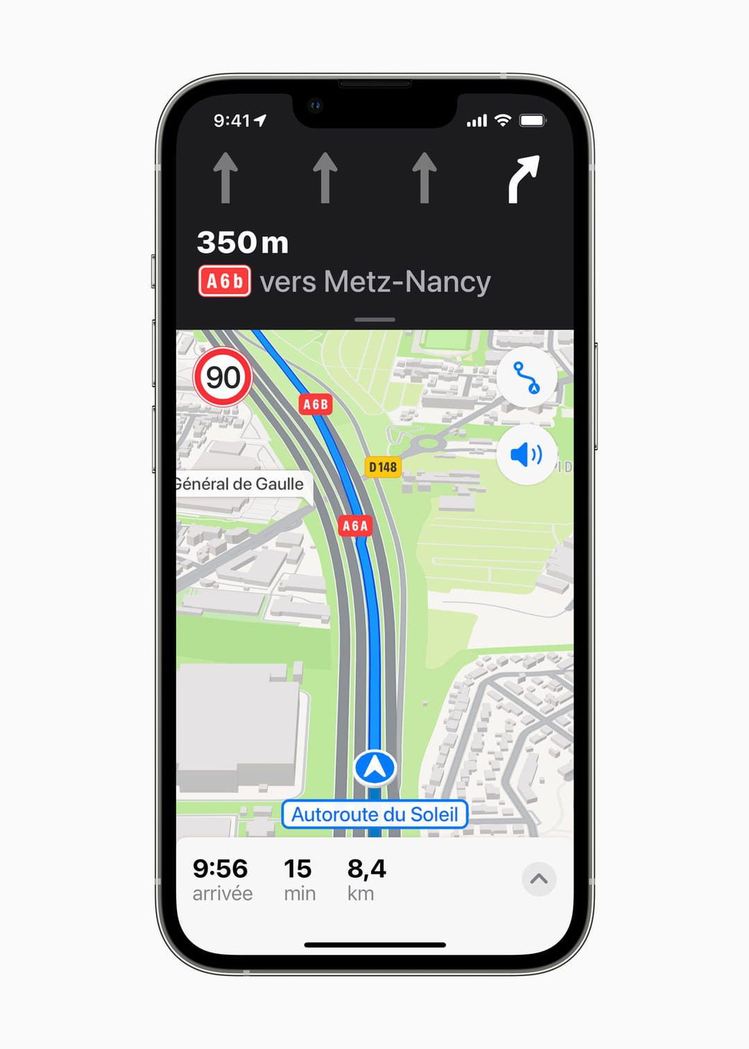
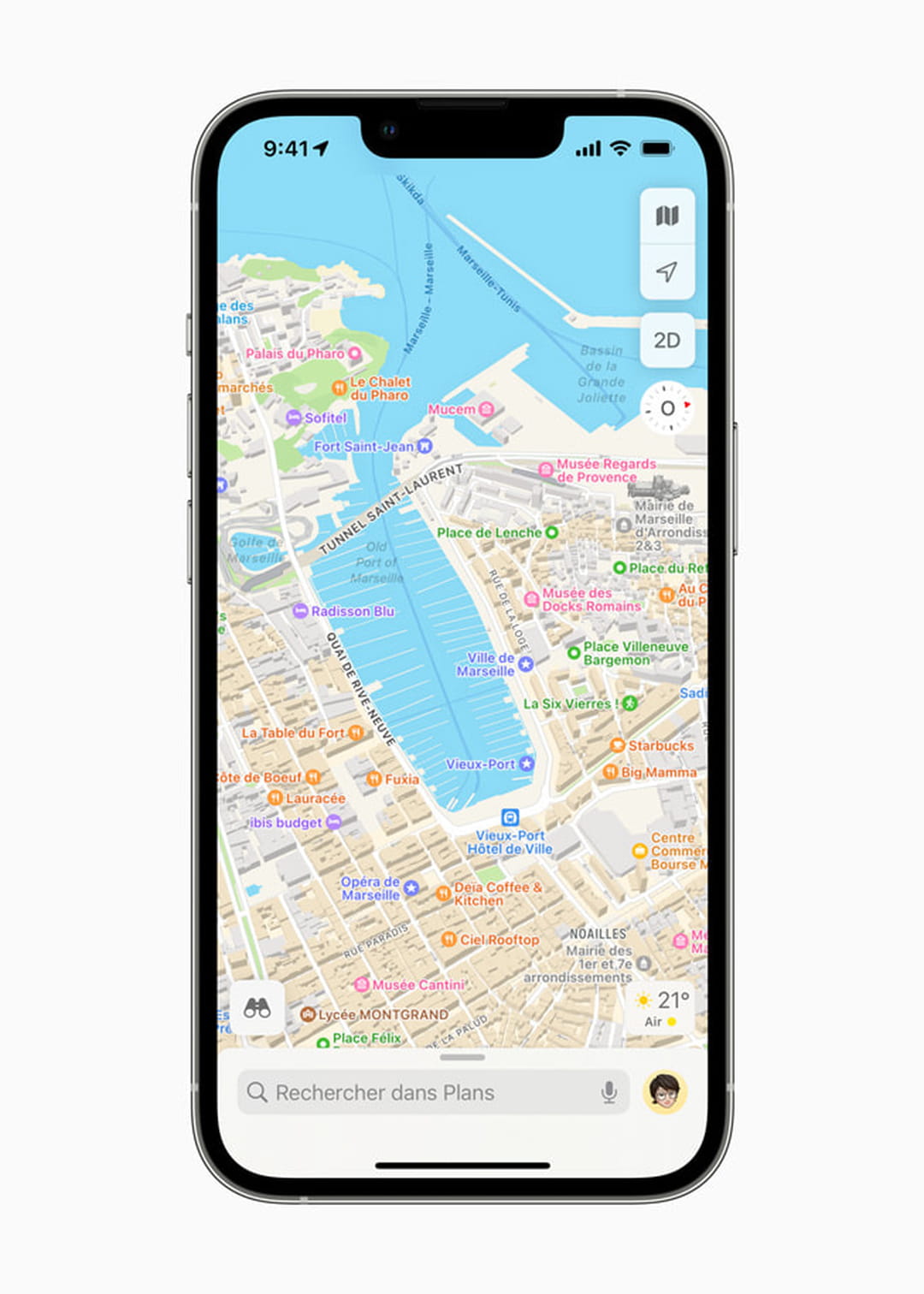
The first thing Apple Maps really needed to work on was map accuracy and readability. Now, city centers, urban areas and vegetation are better visible, and buildings, tourist sites and monuments are faithfully represented. The background map is much more precise, especially the roads, which makes navigation easier. For example, if a lane change looks complicated – loops, tangled roads – the view changes to provide a more detailed rendering of the lanes and which one to take.
Another much-awaited novelty, speed limits! Apple Maps now provides real-time traffic information, telling the driver, for example, how fast to drive on expressways and departmental roads, but also the presence of traffic lights. Users participate in updating the map by telling Siri “there’s an accident” or “there’s something on the road”, or even that the accident is over. In the event of a delay, they can notify their loved ones with a click, who will be able to follow their journey in real time. Finally, it is possible to add the places where you often go to the Favorites, in order to find them more easily.
Immersive and easy navigation
Apple has worked a lot on user browsing conditions. Now Apple Maps can pinpoint where someone is, and even warn them when they’re approaching their bus, train, and subway stops. Moreover, the instructions are given in a more “natural” language. The indications will therefore be “easier to follow, such as ‘turn left at next traffic light'”
But it is especially for pedestrians that the biggest change takes place. A feature now allows users to explore neighborhoods, shopping areas, marinas, buildings, and other points of interest in an unprecedented level of detail. With the Flyover mode, it is possible to fly over large metropolises using a photorealistic and immersive 3D display. Users can move their device around them to experience a city from the sky, or explore streets and landmarks in zoom, pan, tilt, or rotate mode. With Look Around, users can recognize the different buildings modeled in 3D such as the Eiffel Tower, Mont-Saint-Michel or the Arc de Triomphe. Another bonus, people strolling in Paris, Marseille, Lyon and Nice will benefit from immersive walking routes thanks to augmented reality. All you have to do is point the iPhone in front of you to allow the smartphone to recognize buildings and display the next directions directly in 3D. This will make you want to walk a bit! Finally, the app offers maps of airports and malls so users can know their floor, the location of restrooms, and even open stores and restaurants. Note, however, the absence of bicycle trips: a deficiency that is all the more regrettable as it is a mode of transport that is increasingly used in large cities such as Paris. In a future update, maybe…
No need to manually update your iPhone or iPad, the new version is installed automatically.