You will also be interested
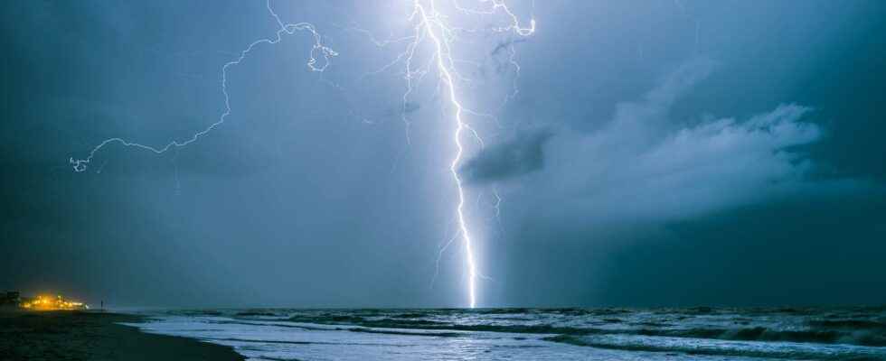
[EN VIDÉO] How do thunderstorms form? France has an average of 250 days of storms per year. How and why are these powerful phenomena born, accompanied by lightning and thunder?
France has just experienced its stormiest day since August 2019: with 41,029 lightning recorded by Weatherstorm, this Saturday June 4 was the most struck down day for almost 3 years. It is also the seventh worst day since 2000.
These thunderstorms were generated by a situation weather report classic for the seasona conflict of air massesbut this one was particularly explosive due to a very large contrast temperatures: between the hot air present on the ground, cold air at altitude and an arrival of fresh air from the Atlantic. This Sunday, the average temperature in France reached 22.1°C, which makes June 5 the hottest day nationwide for more than 100 years (ahead of the 21.6°C on June 5 June 1950).
Many supercells formed, the most violent category of thunderstorms, generating gusts of more than 100 km / h locally in Puy-de-Dôme, Allier and Yonne.
The supercells were also the source of particularly destructive giant hailstones: hailstones reached a diameter of 7 to 8 cm in Puy-de-Dôme, Loire, Allier and Creuse.
Another characteristic of the supercells, torrential rains fell on the center and west of the country: up to 74 mm of rain was recorded in Saône-et-Loire and more than 70 mm also in Sarthe et Loire, i.e. the equivalent of a month of rain in the space of a few hours.
The #thunderstorms yesterday were accompanied by strong accumulations of rain, locally greater than 50 mm:
74.1 mm at Saint Yan (Saône et Loire, opened in 1954), second highest value in one day. Record 96.6 mm on July 2, 2008. pic.twitter.com/W0imiTR1YX— Gaetan Heymes (@GaetanHeymes) June 5, 2022
Some unofficial weather stations emit the possibility that accumulations of 100 mm have occurred in Finistère and Côtes d’Armor. In Rouen, Normandy, a woman in her thirties lost her life when she found herself trapped under her car during the floods.
Impressive cloud structures were photographed everywhere in France: many archthese clouds rollers which always announce the arrival of violent phenomena.
A weak tornado would also have occurred in Haute-Saône, causing damage to the roofsa phenomenon that is not surprising in such violent storms.
⚡️???? [#Tornade] ???? The storm of #Vesoul (70) developed a tornado around 7:00 p.m. this Sunday evening ⚠️ The municipality of Velleguindry (#HauteSaône) recorded the phenomenon of about 1 minute. Several roofs no longer have their tiles and some trees have been uprooted (EF0 intensity) ???? pic.twitter.com/QfaXRuytS5
— Weather Franc-Comtoise (@Meteo_FC_) June 5, 2022
Destructive storms, giant hailstones, tornadoes: what happened in Europe?
Article of Karine Durand published on May 23, 2022
Several ultra-violent stormy waves crossed Europe between Friday May 20 and Sunday May 22, giving rise to extreme weather phenomena: tornadoes, giant hail and torrential rain.
After a week marked by strong heat, the stormy degradation was particularly violent. Between Friday and Sunday, several stormy waves crossed Europe, from the south-west of France to Belgium, then to Germany. In question, an explosive air mass conflict, with hot air rising from Morocco to France, via Spain (raising the mercury up to 35°C in France and 41°C in Spain) and cooler air associated with the arrival of a depression. Ideal conditions for generating supercells, the strongest thunderstorm category. The greater the contrast of air masses, the greater the risk of supercells: to obtain this type of storm, a difference of 10 to 20°C is necessary between these two air masses, exactly what is is produced in recent days.
The stormy wave which crossed France this Friday intensified when it arrived in Belgium and Germany in the evening, the two countries were moreover placed in “ extreme thunderstorm risk “. Several tornadoes formed in thunderstorms in Germany, and one of them was devastating: one dead, sixty injured, millions of euros in damage.
The Paderborn, Germany tornado shape and radar imagery (with a characteristic hook to the south of the storm) is befitting of what can be seen in the Great Plains of America.
???? ???????? ??????????????????????????????? ???????????????????? ????’???????????? ????????????????????????????????????? ???????? ????????????????????????? ??????????????????????????????????’???????????? ! Probable tornadic supercell (hook echo, hook echo) near Sankt Kilian, Thuringia in Germany a few moments ago! #emmelinde#Germanypic.twitter.com/LcEs8J2c08
— Nahel.B (@WxNB_) May 20, 2022
In France, this Sunday evening, a supercell generated giant hailstones of 8 to 10 centimeters towards Niort in Deux-Sèvres: it could be a record for the country.
Large hail of 8 cm towards Niort this evening. Storms had a harder time taking hold in Gironde because of the cloud cover. The storms in Charentes took all the potential for very large hail like the photo below taken this evening. pic.twitter.com/NpVJ3vffTC
— Mathieu Goalard (@mathieu_goalard) May 22, 2022
The extreme size of these hailstones testifies both to the immense height of the storm cloud, and to the violent currents that were present inside.
⚠️ [DIRECT] The storm cell that hit the #Two Sevres generated impressive hailstorms between #Niort and #Parthenay with hailstones reaching 8 cm in diameter, the size of a petanque ball! (Photo taken in Frontenay-Rohan-Rohan by ML KrissGemeaux) pic.twitter.com/D5MGzGQ5pu
— Guillaume Woznica (@GWoznica) May 22, 2022
Under these storms, the rainfall was torrential, with locally 20 to more than 50 millimeters of rain in a few hours, enough to improve the drought situation in Vendée, Maine-et-Loire and Loire-Atlantique.
These storms also generated powerful gusts of windup to 107 km / h in Rosnay in the Indre.
We can clearly see on the sat image this very virulent supercell storm which passed near Niort and which is moving towards Poitiers. We can clearly see the signature of a summit penetrating the tropopause. Sign of the most violent storms. pic.twitter.com/1NvnZypHiJ
— Fabien Delacour (@FabienDel69) May 22, 2022
Interested in what you just read?