Heavy rain and strong winds are expected in western France from Tuesday night to Wednesday. This summer storm should then reach the rest of the northern half as far as Pas de Calais on Thursday with strong gusts forecast by Météo France.
[Mis à jour le 1er août 2023 à 15h29] It is an “exceptional” storm according to La Chaîne Météo which is about to land in the West and North of France. If the phenomenon is in no way synonymous with a record in terms of rain or wind, it is by its date that it surprises since this type of weather phenomenon usually occurs in autumn or winter. Heavy rains, particularly violent winds for the season… The depression approaching France on Tuesday August 1 will indeed give a very turbulent situation according to Météo France.
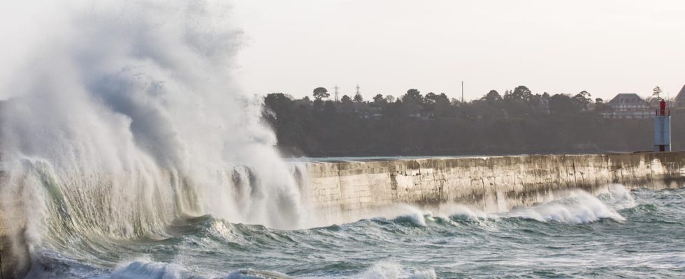
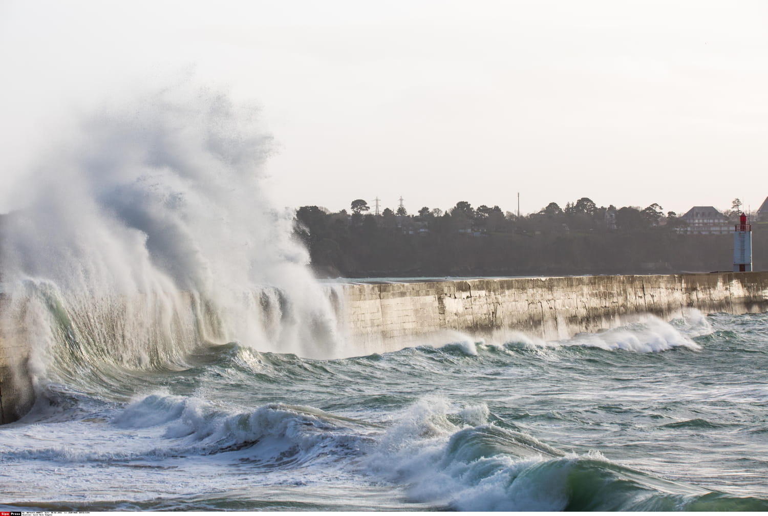
The first sector affected will be Brittany and around the English Channel from the night of Tuesday to Wednesday. The depression will first cross the south of England before approaching the coasts of western France causing “strong gusts on the north-west of the country, as well as heavy rains north of the Seine” , warns Météo-France. The wind could reach 90 to 100 km/h near the coast, even peaks at 110 km/h on the most exposed capes, and still reach 70 to 80 km/h inland.
This animation of the jet stream makes it possible to understand the disturbed week that we are experiencing. The latter circulates above France and is dynamic, a situation worthy of autumn. (via https://t.co/yqwnzuLdMh) pic.twitter.com/cSFY79AauD
— Guillaume Séchet (@Meteovilles) August 1, 2023
Bathing prohibited in several municipalities
Météo-France also warns of a risk of submersion, as strong winds can produce significant waves “on the Atlantic coast and the Channel coasts”. Further east, strong gusts will also be possible from Wednesday, while the 48-hour rain accumulation will be very significant from Nord-Pas-de-Calais to the Ardennes with up to 60mm of rain.
Faced with the arrival of this weather phenomenon, the maritime prefecture of the Channel and the North Sea published an alert message calling “all users of the sea” to “the greatest caution”, and “in particular those who practice shore fishing or who walk on the coast subject to the tide. A few minutes can sometimes suffice to be isolated by the rising tide. High tides have the effect of increasing the tidal range (difference between the height of the high tide and that of low tide), with a greater mixing of sea water and a faster upwelling. They therefore make the sea currents stronger and the sea more dangerous, generating an increased risk of isolation by the tide”.
An unusual gale in the middle of summer and strong waves will affect our departments near the Channel and the Atlantic. The detailed update on our special press release https://t.co/sb63CaWUkH
— The Weather Channel (@lachainemeteo) August 1, 2023
This summer storm also arrives in the midst of a high tide phenomenon, which should increase the risk of submersion with large waves and tidal coefficients exceeding 100. “In a context of high tides, many beaches should raise the red flag because of the waves”, explains BFM TV weather expert Gilles Matricon.
The greatest vigilance will therefore be required on the Brittany coast and on the English Channel, but also on the Atlantic coast for the weekend. Several municipalities have already announced the ban on swimming in their territories. This will be the case in Agon-Coutainville, Montmartin-sur-Mer and Hauteville-sur-Mer in the Manche department, but also in Blonville-sur-Mer and Villers-sur-Mer in Calvados. This ban is valid from this Monday evening and until further notice.