Published 2024-01-30 23.54
unsaveSave
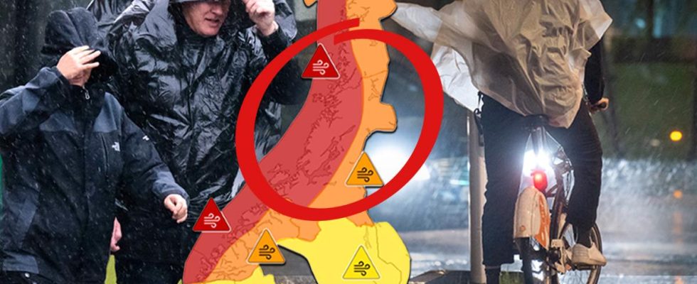
The extreme weather Ingunn may be the worst in Norway in 32 years.
On the night of Thursday, it moves further towards us.
– The storm will be felt throughout Sweden, says Lasse Rydqvist, meteorologist at Klart.
The Norwegian Meteorological Institute has issued a red warning for the extreme weather Ingunn.
On Wednesday afternoon, the storm is expected to reach the northern and western parts of the country. Hurricane winds can be as strong as 50 meters per second.
The red warning, which is the highest, applies to parts of Nordfjord, Møre og Romsdal, Trøndelag and Helgeland.
For about half a day, the storm is expected to cause great devastation. All high schools and several primary schools in Møre og Romsdal are closed.
“It is dangerous to be outdoors, and unusually large damage is expected to buildings, infrastructure, forests and electricity grids” writer Meteorological Institute in a press release.
Red warnings are unusual in Norway.
– It is reminiscent of the New Year’s hurricane in 1992, says meteorologist Unni Nilsen The evening post.
expand-left
full screen Storm Ingunn over Norway. Photo: Meteorological Institute
Canceled flights
Flights, ferries and public transport may be cancelled. In Nordland, there is also a warning that there may be 50-60 millimeters of rain in twelve hours.
Unni Nilsen has a simple appeal for residents in the affected areas:
– Do not go out unnecessarily.
Lasse Rydqvist, meteorologist at Klart, agrees.
– There can be wind gusts of 50 meters per second. That’s quite a bit above what we call hurricane force, 33 meters per second. The force that comes against an object or a person increases significantly for every meter per second that the speed increases, he says.
– It is difficult to stand up at all at 25-30 meters per second. It’s hard for anyone to get into this, no matter what age you are.
expand-left
full screenStorm weather. Photo: Johan Nilsson / TT
Hurricane villages in the Swedish mountains
When Ingunn moves on towards Sweden, it becomes calmer, but still really windy.
SMHI has issued orange warnings for gale force winds and snowfall around the mountain areas in northern Jämtland, Lapland, northern Dalarna and Jämtland County.
The person is strongly advised against going out on the mountain.
– It will start to blow up at Jämtlandsfjällen on Wednesday evening, and we will probably have hurricane villages there already around midnight on the night of Thursday, says Lasse Rydqvist.
During the small hours, the storm will then move further north. During Thursday morning, it looks like it will be really windy in the Jämtlandsfjällen and Laplandfjällen.
– It is absolutely not impossible with wind gusts of over 40 meters per second during the day.
expand-left
full screen Lasse Rydqvist. Photo: Magnus Wennman
“Storm Force”
According to Lasse Rydqvist, the storm will certainly be felt throughout Sweden on Thursday.
– Partly, there can be hurricane villages east of the mountains as well. But there can also be storm force in the village winds over Gävleborg and Uppland, it is not impossible.
As it looks now, the wind will pick up Thursday evening and Friday night. But the windy weather is not over yet – on Saturday a new low pressure will arrive.
There, however, most things seem to be caught up by Norway.
