Save the article
full screen
Next
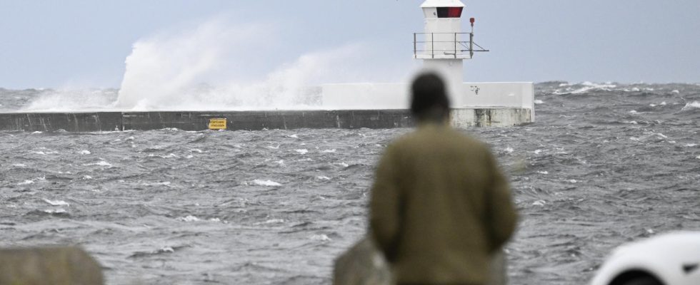
The waves whip against the breakwater at the Falsterbokanalen in Höllviken.
1 / 2Photo: Johan Nilsson/TT
Storm Babet is moving in over Sweden and is expected to hit the southern parts hardest.
SMHI warns of the risk of extensive flooding in southern Skåne at the same time as train and air traffic is affected.
It is the British Meteorological Institute that has named the storm Babet.
– Great Britain has a very deep low pressure over it and at the same time we have a high pressure over northern Sweden with cold air. This is what creates a strong wind over southern Sweden, says Ida Dahlström, meteorologist at SMHI.
From the afternoon, strong gusts of wind are expected in southern Halland, Skåne, Blekinge and southern Öland. From nighttime, this also applies along the west coasts of Vänern and Vättern.
SMHI has also issued an orange warning for high water levels in the Baltic Sea along the south coast of Scania with a risk of flooding that could affect both roads and railways. Harbors and coastal buildings risk major damage.
“Storm villages are expected”
– For southern Skåne, it will be windiest during the evening and night. Then storms are expected there, says Ida Dahlström.
Particularly vulnerable is Skanör–Falsterbo, where the municipality of Vellinge has been equipped with a flood defense to protect Skanör’s urban area.
– We take this very seriously. We will do everything we can to ensure that there is as little impact as possible, says the municipality’s technical director Ulf Andersson to P4 Malmöhus.
From 15:00 this afternoon, train traffic will be closed for the next 24 hours on several routes in Skåne, and certain routes will also be affected in Småland.
The storm also means that Kastrup airport in Copenhagen is currently canceling 71 out of 750 planned departures or arrivals.
– It is the airlines that make decisions. They mainly concern smaller planes that have been cancelled. Most can handle a lot of wind, but it can be problematic to get passengers in and out of the airplanes when it is very windy, says Agnes Kreinøe, communications manager at Kastrup airport, to TT.
Elements of snow
Ferry companies state that departures to and from Ystad and Trelleborg to Germany and Poland are cancelled. Scandlines announces that the Rödby–Puttgarden line will not operate on Friday.
There is also a risk that the Öresund Bridge will be closed, which will happen if the average wind reaches 25 meters per second. The Öresund Bridge writes on its website that the risk appears to be highest from 8 p.m. this evening until early Saturday morning.
The rain will increase during the evening and during Saturday the storm will move up the country. When it reaches the southern Swedish highlands, the interior of Götaland can also receive snowfall.
– But it is not snow that is expected to settle on the ground, but it will be very wet, says Ida Dahlström.
FACT Train traffic is cancelled
SMHI has issued a yellow warning for very strong gusts of wind in southern Halland, Skåne, southern Blekinge and southern Öland from Friday evening.
An orange warning prevails for high water levels in the Baltic Sea along the southern coast of Scania. Harbors and coastal buildings risk major damage. SMHI also warns that some ports may be unreachable and that moored boats and ships may be damaged. There is also a risk of erosion damage.
In Skåne, train traffic will be closed at 3 p.m. this afternoon one day ahead on the following routes: Svågertorp–Trelleborg, Svågertorp–Simrishamn, Ramlösa–Teckomatorp–Eslöv, Karlskrona–Kristianstad. Buses will replace, Skånetrafiken writes on its website.
At the same time, traffic is suspended on two bus lines in Skåne, partly between Malmö and Skanör and partly between Örkelljunga and Helsingborg.
Train traffic will also be down between Kalmar and Linköping due to the storm, as well as between Halmstad and Värnamo.
Read more
