What are the stocks of fresh water on Earth? How can we optimize maritime transport and fishing, better develop the coasts and better understand the influence of the oceans and the water cycle on our climate? These are the questions to which the SWOT satellite (Surface Water and Ocean Topography) will try to answer.
If his departure, scheduled for Thursday December 15, was delayed due to unfavorable weather, he finally took off from the launch pad of the Vandenberg space base (California, United States), this Friday December 16, at 12:46 p.m. from Paris). Powered by a SpaceX Falcon 9 rocket, the 2.3-tonne satellite born from a collaboration between the French (Cnes) and American (Nasa) space agencies will finally begin its mission. Its goal: to draw up an inventory of surface water on Earth and measure the height of our oceans, seas, rivers, lakes and flooded areas.
Map freshwater reserves
“Swot sends its radar signal to Earth and receives it using two antennas, which allows it to triangularize the signal, explains Nathalie Steunou, system manager at Cnes, interviewed by L’Express. Thanks to this mechanism, it can perform a ‘wide swath’: it scans strips 120 kilometers wide under it while circling the Earth. And since it shifts a little with each orbit, it can therefore establish a complete cartography of the globe every 21 days”. Even better, the Franco-American satellite has a precision 10 times greater than that of all satellites of the same type. Enough to produce data of unrivaled quality that will be useful to scientists, States and their citizens. Because the results of the satellite will have environmental, commercial and geopolitical implications.
Swot will perform, for the first time in history, a 3D mapping of fresh water reserves on the Earth’s surface. He will thus see millions of lakes, rivers or flooded areas that were not observed until now, because they were too inaccessible or because they disappear and appear according to the seasons. And by measuring the level of the lakes, Swot will determine their water stock.
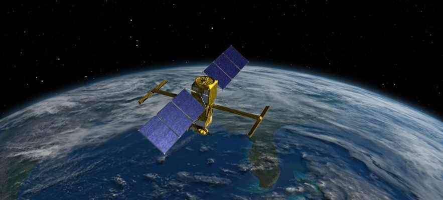
Swot has a radar on board which sends a signal to the ground. The two antennas, separated by 10 meters, then measure the round trip time of the signal, which makes it possible to determine the average water height with an accuracy of one centimeter.
© / NASA/JPL-Caltech
“It will also make it possible to measure the flow of rivers with precision, which is particularly useful since the economic activity – agriculture, hydroelectric production, commercial navigation – of many countries depends on it”, adds Thierry Lafon, head of the Swot project at Cnes. , also questioned. And since the great rivers of the planet often cross several States, Swot will know if there are countries which withdraw more water than necessary compared to the needs of their neighbors. “This will raise and/or resolve geopolitical questions,” notes the Cnes manager.
Swot will therefore deliver a “global water vision” of the Earth every 21 days. Researchers will know where fresh water comes from, where it goes and how stocks evolve. Thus, the States will be able to improve the management of water forecasting and consumption and better anticipate drought, for example by taking measures to ban watering at the appropriate time.
Environmental objective
The other objective of Swot will be to measure the height of the oceans as well as the “ocean circulation”. The incredible precision of the satellite will make it possible to better observe ocean currents such as the Gulf Stream, which condition our climate, but also the myriad of small currents that make them up. Enough to improve our knowledge of marine biodiversity, since these currents condition the movement of nutrients and marine animals, and our management of fishing.
Above all, these data will make it possible to better understand the exchanges between the oceans and the atmosphere, which are crucial for the climate. “The oceans play a fundamental role in the absorption of CO2 [un gaz à effet de serre, NDLR], specifies Thierry Lafon. They absorb 90% of the excess energy present in the atmosphere. If they didn’t, it would be between 60 and 70°C on Earth”. These analyzes will help climatologists refine their models and better understand what global warming has in store for us in the years to come. Its measurements will also make it possible to reveal the underwater mechanisms since if its radar does not make it possible to probe directly under water, the scientists know how to translate the surface measurements to determine if there are currents of hot water, relief submarine, etc
Finally, Swot will observe with great attention the coastal areas, which concentrate the majority of human activity but which are increasingly weakened by storms and rising waters. “We need to know more precisely the impact of the climate on changes in the coastline and thus better predict disasters, anticipate land use and land development”, Thierry Lafon continues.
An ecological end of life
The lifetime of the mission was set at 42 months. After this time, Cnes and NASA will meet to allocate a new budget or not. “But technically, there is nothing preventing the satellite from living 5 or 7 years. On the other hand, the older it gets, the more the probability of a failure will increase, especially since the technology it embeds is very complex and potentially fragile in the long term”, indicates the project manager.
At the end of its life, the Cnes will be responsible for carrying out a controlled re-entry, that is to say adjusting its trajectory so that all the debris burns up in the atmosphere or falls to Earth without risk. “We have the will not to leave this object in space for thousands of years”, welcomes Thierry Lafon, who recalls that the fight against waste in space is a priority for Cnes. Swot, green all the way.