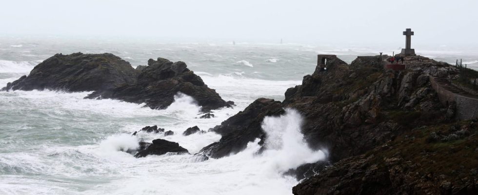
Météo France has already placed three Breton departments on orange vigilance for the evening of Wednesday November 1 and is considering red vigilance. The SNCF has already canceled numerous TER journeys.
The essential
- Storm Ciaran crosses the Atlantic and gains strength before hitting the French coast. The low pressure system is expected to blow its first gusts onto the Breton coasts on the evening of Wednesday, November 1st before lashing part of the country on the day of November 2nd.
- While the scale of the phenomenon described as “quite exceptional” is still difficult to anticipate, Météo France is refining its first forecasts. Three departments are placed on storm alert for winds from 9 p.m. this Wednesday: Finistère, Côtes-d’Armor and Morbihan. These territories will be the first and perhaps the hardest hit by the storm. “There remains uncertainty about the intensity of the wind gusts” but it is established that some will be “extremely violent” warns Météo France: “We expect up to 150 to 170 km/h potentially on the coast”. An opinion which agrees with that of Météo Bretagne.
Live
4:20 p.m. – Already three departments on orange alert
Storm Ciaran is expected to reach the French coast, and more particularly the Breton coast, this Wednesday, November 1 in the evening. Until then the forecasts may still evolve, but Météo France has already placed three departments on orange alert for the wind: Finistère, Côtes d’Armor and Morbihan. It is logically the three departments at the tip of Brittany which are the first affected by an alert, but the list could and should grow as the storm passes. Finistère and Morbihan are also placed on orange alert for rain-floods. The alert is scheduled to begin Wednesday from 9 p.m.
Everything you need to know about the storm
Submergence forecasts and risks
Gusts of up to 150 km/h and waves of 10 meters
A large northwest quarter will be swept by storm Ciaran and its violent winds. The gusts should be more powerful on the Breton and Normandy coasts with gusts between 120 and 150 km/h. The French Observatory for Tornadoes and Violent Thunderstorms reports peaks of up to 160 km/h locally. And if it should gradually lose power as it sinks further inland, the wind should remain violent: gusts between 110 and 120 km/h over Normandy and the Pays de la Loire and between 90 and 110 km/h. h approaching Ile-de-France are announced. The storm could even blow as far as the limits of Hauts-de-France and New Aquitaine.
The wind from Storm Ciaran should be accompanied by a “submersion wave phenomenon” with “very strong waves expected” across the entire Atlantic coast. Météo France announces waves between 8 and 10 meters all around the ocean. The Kéraunos observatory fears waves measuring up to 13 meters. It will be necessary to be vigilant to the risk of submersion and flooding which will be reinforced by the fairly low atmospheric pressure which will raise the water level. “Sometimes sustained” precipitation is also mentioned by forecasters.
The risks of wave-submersion are particularly feared in the departments on the Atlantic coast already affected by storm Céline during the last weekend of October. Floods have already occurred in certain coastal towns such as Cap-Ferret, Noirmoutier, Quimper and Pornic and the tides were higher.
In addition to the wind, the values of which remain to be refined, the depression #Ciaran will generate a strong swell (period 15/17 sec).
Significant wave heights are expected to exceed 13 m in the Atlantic on Thursday morning. pic.twitter.com/SE7HUPh9jM— Keraunos (@KeraunosObs) October 30, 2023
Which regions will be affected?
Brittany will be affected and could be the region most exposed to Storm Ciaran. Three of its departments are already on orange alert for the night of November 1 to 2, because it is through the Breton tip that the depression will arrive in France before sinking into the lands of the northwest quarter. The Breton coastline and the Normandy coasts should be monitored.
The lands of Normandy and Pays-de-la-Loire could also be affected, as well as the regions of Hauts-de-France, Ile-de-France and Centre-Val de Loire although in these territories the risk seems less significant for the moment according to Météo-France.
To a lesser extent, some departments in the southwest, notably Gironde and Landes, could be swept by the tail of the storm during the night of November 2 to 3 with winds at 100 km/h and waves between 6 and 7 meters. , or even up to 10 meters exceptionally in the Bay of Biscay. Note that the final trajectory of the storm has not yet been finalized and the forecasts could be adjusted.
A storm strengthened by the jet stream
Storm Ciaran is expected to gain strength as it crosses the Atlantic. This depression coming from the American continent swells under the effect of the very powerful winds of the “jet stream”. The current is a sort of corridor several thousand kilometers long in which depressions circulate freely. It marks, as it were, the separation between the cold air coming from the north pole and the warm air coming from the tropics, a contrast which only reinforces the depressions.
