Well-crafted seafloor maps help with navigation and environmental protection, among many other uses.
About 10 million square kilometers of new bathymetric (depth) data were added last year. This is roughly equivalent to the land surface of Europe.
The update was presented at the United Nations (UN) Ocean Conference, which took place this week in Lisbon, Portugal.
In fact, much of this additional data is the result of governments, institutions, and companies agreeing to open their archives rather than mapping efforts. Another 10-15 percent of data is thought to be kept on servers for security or commercial reasons.
Jamie McMichael-Phillips, director of Seabed 2030, which works to get the full picture of the world’s ocean floor, says they “don’t need to worry” about this.
“We don’t need high-resolution data. High-resolution data is fine, we can work with them. But lower resolution is perfectly acceptable. A depth value of 100 meters by 100 meters or so, the size of a European football field, will not reveal national or trade secrets.”
Nautical charts are essential not only for the safe navigation of seafarers, but also for fishing and protection.
Marine wildlife tends to congregate around underwater mountains. Every seamount is a biodiversity hotspot.
It also affects healthy seafloor, ocean currents and vertical mixing. Maps are also used to improve studies of climate change, as the oceans play an important role in moving heat around the planet.
Currently, our knowledge of just over three-quarters of the planet’s underwater floor is limited only by low-resolution satellite measurements that reveal the presence of high seamounts and deep valleys.
However, submarine mountains can be hundreds of meters high, and observations are generally not enough to reveal the base map and have information about the base.
Funded by Japan’s Nippon Foundation, the Seabed 2030 encourages anyone away from land to turn on their sonar equipment and drill deep. Not only do these have to be measurements from large ships, small ocean yachts equipped with data loggers can also contribute.
American adventurer Victor Vescovo, one of the financiers of Seabed 2030, uses a submarine to visit the deepest parts of the world’s oceans. Vescovo tells the BBC it’s a “map the gap” strategy:
“We’re not a commercial team, so we don’t have to take the most fuel-efficient routes. When we go on an expedition, we’re like, ‘What are your priority areas?’ We ask, and we change direction a bit to cover these areas.”
A former employee of the US Navy alone contributed more than 3 million square kilometers.

However, many parts of the world are so remote, let alone obtaining depth data in these regions; Few ships can visit them.
Autonomous or semi-autonomous technologies are required to map these places.
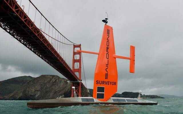
Last year, the 22-metre robotic watercraft Saildrone Surveyor mapped 22,000 square kilometers of the seafloor on a 28-day voyage between San Francisco and Honolulu.
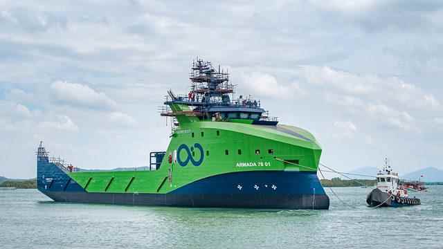
Marine robotics firm Ocean Infinity is currently building a fleet of 78-metre-long ships in Vietnam. The goal is to have them navigate the ocean without anyone on board. Its work will be overseen from satellite-linked control centers located in the UK, USA and a third location in Asia.
Such ships can be sent on long missions to map hard-to-reach areas at much less cost than a traditional crewed ship.
Progress towards full mapping of the seafloor was also discussed at one of the meetings at this week’s UN Ocean Conference. While the participants agreed that new technologies are necessary, Dr. Lucy Woodall warned that the 2030 project will fail unless the data is addressed.
He cited companies that go to coastal areas to map the seafloor, but do not share this data with local peoples whose livelihoods depend on these waters.
