unsaveSave
expand-left
full screen
chevron-rightnext
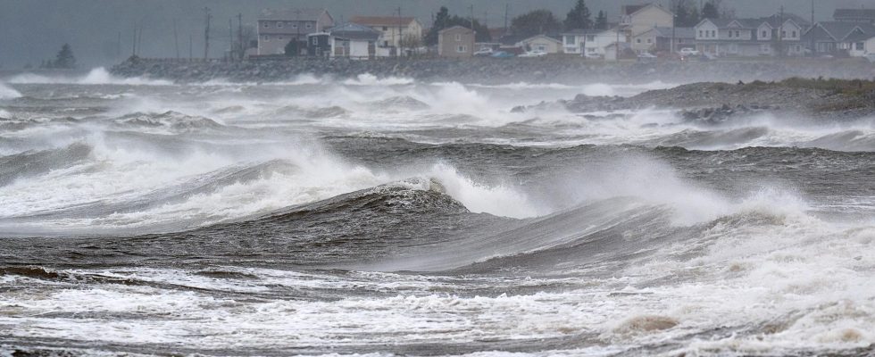
Forecasters have expressed concern about an extreme Atlantic hurricane season. Archive image.
1 / 2Photo: Andrew Vaughan/AP/TT
Strangely summer-warm seawater in the North Atlantic already in February. With the help of the weather phenomenon La Niña, it can make the hurricane season extreme.
– It is very strange what is happening now, says oceanographer Ola Kalén.
For almost a year, it has been unusually warm in the world’s oceans. In March 2023, the temperatures in the surface water began to break records – and so it has continued in a development that scientists labeled as worrying.
– Temperatures will likely continue to rise, we usually see a peak in March of the year, says Ola Kalén, oceanographer at SMHI.
– But last year we had an equally high peak in August, that has never happened before. It is very strange what is happening now, it goes beyond anything you have seen before. It has become much worse than predicted.
Corals are threatened
Can you already see the effects of the high temperatures?
– One thing that stands out is that the American climate institute NOAA has introduced three new levels on its warning for coral bleaching, previously they only had two, says Kalén.
– The heat has drastic consequences for corals. It is the ecosystems that are most exposed to the heat and the changes that are taking place. If we exceed a global warming of 2 degrees for a longer period of time, basically all coral reefs will disappear.
In the North Atlantic, temperatures prevail that are usually measured in the summer. That has forecasters scrambling for the start of hurricane season, still three months away.
For tropical storms to form, the ocean must be warm.
– Hurricanes in the North Atlantic are usually generated in an area that stretches from West Africa to the Caribbean. It’s a couple of degrees warmer than normal there now, much like it usually is at the end of summer.
The weather phenomenon El Niño looks set to be replaced by the opposite condition La Niña later this year.
– It is a situation for an extreme hurricane season. It is connected with the likely change to La Niña. We have probably passed the El Niño peak and the forecast is a quick change to La Niña in late spring or early summer, says Kalén.
– We know that La Niña conditions tend to boost hurricanes. It depends on how the winds in the atmosphere work.
Reduce emissions
The reason for the record-warm seas is the climate change caused by human emissions, with the help of, among other things, El Niño, which gives the global average temperature an extra boost.
– The only thing you can do is to start taking global warming seriously and not postpone measures. We have to realize that there is no other way than to quickly change society to reduce emissions, says Kalén.
FACTS Affects the weather
El Niño and La Niña are phases of the El Niño-Southern Oscillation (ENSO) weather cycle. El Niño warms the surface water in the eastern parts of the Pacific Ocean while La Niña cools it.
El Niño returns on average every two to seven years and usually lasts nine to twelve months. The climax often occurs around Christmas, hence the name El Niño (the boy).
El Niño effects such as increased rainfall typically affect parts of southern South America, the southern United States, the Horn of Africa, and Central Asia, while severe drought may occur over Australia, Indonesia, and parts of southern Asia.
In 2023, a multi-year episode of La Niña ended. During the summer, instead, El Niño officially entered the Pacific Ocean.
Sources: WMO, SMHI
Read more