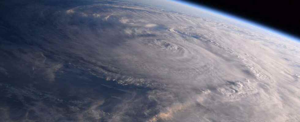
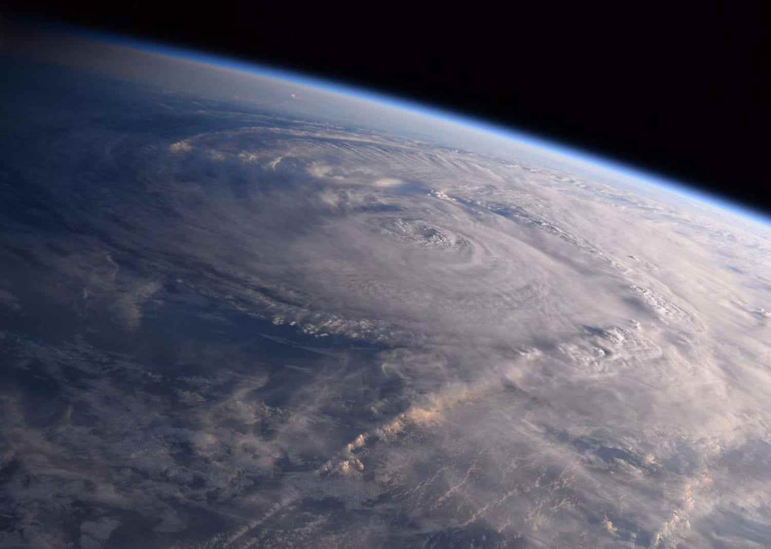
DANIELLE. A hurricane ? A storm ? Danielle will in a few days be just an ordinary depression in temperate latitudes. No hurricane will cross France, therefore.
Don’t panic… France is not going to be hit by a hurricane. The hypothesis of such a phenomenon has been ruled out if we are to believe the latest forecasts of The weather channel. Hurricane Daniel will very quickly see its power drastically decrease over the days, with a possible arrival off Ireland […] for next weekend. Danielle will in any case have lost all of its tropical characteristics to become just a simple depression that is usual in temperate latitudes. It would bring “unstable and windy weather to the north-west of France, circulating at the level of the English Channel”.
In addition, according to La Chaîne Météo, it could even be that the weather is fine over most of France if the preferred scenario is confirmed: “This classic evolution would cause, at the front, an increase in the atmospheric pressure field with the swelling of an anticyclone over France during the next weekend. In this case, not only would Danielle not arrive on our shores, but in addition, the weather would be nice over France.” Failing to barricade yourself while waiting for the end of the world, you could well walk in complete serenity on Saturday September 10 and Sunday September 11, 2022.
In France, will hurricane Danielle hit Brittany?
Subject to increased meteorological monitoring for several days, Hurricane Danielle is evolving over the days and continues to progress towards Europe and, therefore, France. However, the patterns on the progress of the phenomenon in the days to come are complex. The weather channel explains that the reliability of the forecasts is not yet 100% certain. The only certainty is that no major hurricane will hit France or Europe.
According to forecasts by La Chaîne Météo, the most likely scenario is that of a slow progression towards Europe, with a “gradual weakening”. Storm Danielle “would then become a simple depression before arriving on the coasts of Western Europe”. As MétéoContact specifies, “the system is weakened by cold water and will not present any particular risk.
Here tonight is a summary of the different possible trajectories of the hurricane #Danielle offered by several models. A landing is possible on the West of the #Francebut the system will be weakened by the cold waters and will not present any particular risk. pic.twitter.com/FAGdKvvuFC
— Guillaume Jauseau (@GJauseau) September 5, 2022
What trajectory for Hurricane Danielle?
But the forecasts will only be able to evolve with precision two or three days in advance. Danielle’s eventual arrival at the gates of Europe could take place over the coming weekend. Be that as it may, it is well and truly weakened and without any of its hurricane characteristics that it will approach the French and European coasts.
According to the US National Hurricane Center (NHC), the disturbance generated by Danielle will already be very weak before reaching European shores. According to projections, the phenomenon will still be very far from the continent this Sunday.

Storms in France because of Danielle?
The Weather Channel would like to point out that the existence and trajectory of hurricane Danielle could generate indirect effects on the European continent from September 12: “Danielle’s approach would cause the wind to shift to the southern sector, which which could bring up new storms in the south of France as well as in Spain. This deterioration would be an indirect consequence of the arrival of the ex Danielle”, indicates the media.
What caused Hurricane Danielle?
Hurricane Danielle was discovered Friday, September 2, 2022 in the mid-Atlantic, west of the Azores. It was then 3000 km from the coast of Europe. A sector very little conducive to the development of hurricanes. However, the sea temperature being higher than usual (between 4 and 5°C higher, around 25°C), this was more favorable to the formation of the storm. However, the waters being cooler in the direction of Europe, it will lose power and will not approach the continental coasts under hurricane status.