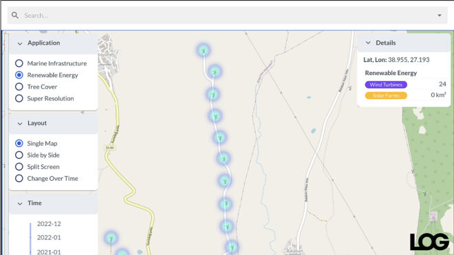
A map where you can see wind turbines and solar farms in Turkey and other countries It was published.
Directly from here you can reach Satlas, has made a sound as an interactive map covering almost the whole world. Behind the map that can be used on standard internet browsers Allen Institute for AI and co-founder of Microsoft Paul Allen is located. Thanks to this map, renewable energy projects and tree presence around the world can be seen clearly. Wind turbines, solar farms and more in Turkey can also be detected. It can reveal the change of the selected region between 2016 and 2022. satlas, “Super Resolution It also has a powerful feature. This is the option that can be selected from the category in the upper left corner, European Space Agency developed by Sentinel-2 usable images by processing low resolution photos from satellites with artificial intelligence (Imaginary building etc. images are produced) is forming. It is stated that the data is updated monthly. satlas, seems important to see how much the tree presence in an area has changed over time, The focus here, as you can imagine, is global warming.. To develop Satlas, the Allen Institute team said they manually reviewed satellite images of 36,000 wind turbines, 7,000 offshore platforms, 4,000 solar farms, and 3,000 woodlands. The team, which enables the deep learning models they use to identify wind turbines or solar farms on their own, Satlas It seems to be the basis of many studies with