You will also be interested
[EN VIDÉO] Earth is darkening due to global warming and that’s not good news For 20 years, the albedo of the Earth has decreased by 0.5%. As it reflects less solar radiation, the planet will absorb more heat, which risks aggravating global warming.
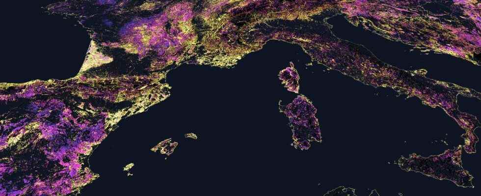
In order to better understand the consequences of climate changeto visually explore the consequences in the different regions of the globe, the largest collection of geospatial data in the world is used to generate an atlas that allows ” assess the health of the Planet in near real-time to inform vital actions on weather says Dan Pisut, environmental content manager for Esri’s Living Atlas of the World.
Unlike theIPCC Atlas which makes it possible to generate maps of a region in its past, present and future, juggling with the different scenarios envisaged by the IPCC, the Living Atlas collects and maintains a diverse set of geographic, historical, and real-time information from geographic information systems (GIS) professionals around the world. This content is then selected and reviewed by Esri staff for quality, timeliness, and relevance to create the ” the most complete information resource in the world concerning the environment of the Planet through a multitude ofhealth indicators “. The real power of GIS lies in the ability to combine different data sets through location to understand the big picture in a given area.
Examples of Earth health indicators that can be categorized include natural hazards, climate monitoring, environmental threats, health of ecosystems and human risks.
The Living Atlas is like our Planet’s geospatial nervous system, which sends vital signals about the health of the Planet in near real time.
The Living Atlas can be considered the ” geospatial nervous system of our Planet that sends vital signals regarding the health of the Planet in near real time “. It was designed to ” helping people working on the world’s biggest challenges, to help them find and use authoritative data that enables them to do their work “. Combined withArtificial intelligenceIt is ” also able to imagine what our world might look like if no action was taken “. In turn, this information helps key leaders quickly take ” informed decisions about climate change so as to build a better future resilient “.
Track the health of the Earth in real time
With this Living Atlas, Esri is betting on providing ” daily tracking of the Planet and Earth observations through the Living Atlas because that’s what our users need to do their job “. Monitoring the Planet is essential to understand its evolution, whether on the scale of 50 years or 5 days. Events such as ” volcanic eruptions can dramatically reshape landscapes and environments within hours or days, while larger-scale changes, such as Deforestation or the melting of glaciersoccur over decades “. In summary, this Living Atlas shows what ” we can see and makes us hear what is going on so that its data constitutes a “ baseline against which we can compare future changes “.
Tracking Earth health indicators daily also helps to “ better understand the consequences of disasters and their downstream impacts “. For example, the ” floods of farming lands in the spring can contribute to the proliferation ofalgae pests in summer pesticides seeping into river systems “. Another example, this monitoring can help identify trends, “ that we can act on before the opportunity arises “. As was the case in 2019 with the ” widespread deforestation of the Amazon by forest fires “.
As the IPCC recently noted, climate change will have significant impact on food resourcesas crops currently grown in some locations may not be viable in the future “. Therefore, Esri is currently working in partnership with agencies and researchers to understand how climate change will impact pastures and change the suitability of land for various crops “.
Short video showing monthly evapotranspiration near the Okavango River Delta. © LivingAtlas
A data overlay to produce your own maps
The Living Atlas also offers the ” ability to combine different datasets through location to understand the whole situation in a given area “. As everything that happens on the Planet happens somewhere, ” we can overlay data at a given location and explore how different phenomena can interact, influence and impact each other “. For example, in ” comparing sea surface temperature with the extent of sea ice, exploring Covid rates in a city against neighborhood demographics, or plotting particulate air pollution against respiratory disease rates “.
While the sensors who collect the data and the formats in which it is stored can be diverse, “ location provides the common lens to intelligently analyze and understand the relationship between where something is happening and why it is happening “.
We realize that the interest of this Atlas is not only scientific. It is useful to a very wide variety of users from the private and institutional sectors “. In the future, by continuing to capture and collect data on the biodiversity and habitats, the idea is to use them to feed models and estimates on the evolution of life on the Planet “. Dan Pisut adds, by way of conclusion, that “ notWe will continue to develop the Living Atlas and create new and updated feeds that meet the needs of our users. We continue to work with national government agencies, NGOs, academia and industry to build the collection of data, maps andapps the most usable to help them make better decisions, accomplish their missions and build a more resilient future “.
the Living Atlas Blog explains how to use the Atlas and produce your own maps.
Support an editorial team committed to popularizing science on Patreon!
Our mission ? Return the knowledge accessible to everyone.
We produce our own articles, investigations and reports every day, all on a human scale. Support us in this approach and this ambition.
Subscribe to Futura on Patreon!
Two subscription plans are offered to you with the following advantages:
- ” Futura ad-free »: get guaranteed ad-free access to the entire site for €3.29/month (+VAT).
- ” I participate in the life of Futura »: in addition to access without advertising, take part in the life of our independent media (votes, new content, surveys, etc.) for €6.29/month (+VAT).
Interested in what you just read?