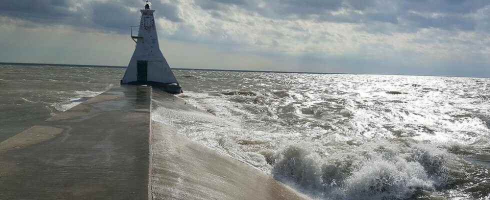
Water levels on Lake Erie and Lake St. Clair are down compared to recent years, but still well above average, say conservation authority officials.
The Lower Thames Valley Conservation Authority stated that average daily levels on Lake Erie at the beginning of May were around 174.60 m, which is down about 28 cm from last year’s peak daily average record set in July.
The all-time record high monthly average for May was 175.08 m, set in 2020. Levels at the beginning of May were still 27 cm above what would be considered normal for the month.
Forecasts suggest that levels are well into their seasonal spring rise and should only climb 2 to 3 cm by the beginning of June, the LTVCA added.
Average daily levels on Lake St. Clair at the beginning of May were around 175.45 m, down about 36 cm from last year’s peak daily average record set in July.
The all-time record high monthly average for May was 175.98 m, set in 2020. Water levels at the beginning of May were 30 cm above what would be considered normal for the month.
Forecasts suggest that levels are also into their seasonal spring rise and should only climb 2 to 3 cm by the beginning of June.
Current water levels on the lakes are still around 30 cm above average for this time of the year. Water levels on both Lake Erie and Lake St. Clair have fallen back down below May levels seen from 2017 to 2021.
However, those water levels are only slightly lower than those seen in 2017 and 2021.
With lower levels, the risk of shoreline flooding has decreased. Along the Lake St. Clair shoreline, it is expected that sustained gale force winds (above 60 km/h) would now be needed to produce shoreline flooding.
Along most of the Lake Erie, shoreline conditions have also improved. Some areas along the shoreline are also now looking at wind speeds closer to gale force before flooding would occur.
“However, conditions have not improved much for Erie Shore Drive,” the LTVCA added. “There are still areas along Erie Shore Drive where flooding seems to begin at around 35 km/h from a southerly (southwest through southeast) direction.”
Erosion and shoreline damage remain concerns along the Great Lakes shorelines. The bluff areas along Lake Erie are also at a greater risk of erosion due to the high water levels.