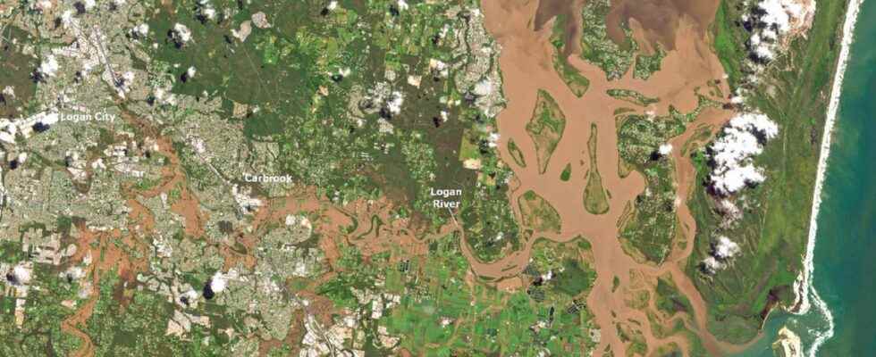
Since late February, eastern Australia has been swamped by torrential rains that have flooded 1,000 km of land from Queensland to New South Wales. Greater Sydney has once again been hit by historic rains in recent hours.
You will also be interested
[EN VIDÉO] How to deal with natural disasters? Every year many natural disasters ravage the countries of the South. Unfortunately, with the few means available, the management of these states of crisis is often problematic. Sébastien Hardy, geographer of the IRD (Research Institute for Development) talks to us during this video about the solutions envisaged by the organization to deal with the problem.
At least 18 people died in these catastrophic floods, even more widespread than those of 2011 which hitherto referred to. The rains led to massive surges, depriving some towns of electricity, communication, food, drinking water and gasoline for a week. The amount of damage is currently estimated at nearly 1 billion dollars according to The Insurance Council of Australia.
On Monday and Tuesday, 120 to 150 mm of rain again fell each day in New South Wales, including sydney. These rains are associated with violent thunderstorms with wind at 90 km/h and hail. This second salvo of bad weather extends until Wednesday, before a lull, with still rains in forecast, but less heavy.
Unprecedented rainfall totals
Since February 22, eastern Australia has been confronted with “atmospheric rivers”, bands of highly concentrated water vapor present in the atmosphere. These corridors of humidity extend over several hundred kilometers and give rise to torrential rains when they encounter land. February atmospheric river generated record rainfall for 10 days: nearly 400mm of rain in less than 24 hours in some Queensland cities such as Wolvi Creek and 676mm of rain in 3 days in Brisbane, unheard of since records began weather reportin 1840.
In the town of Doon Doon in New South Wales, 1,040 mm fell in two days, or one meter of rain, while the average is 10 mm per month at this time of year. According to the Australian weather specialist Ben Domensinosuch an event presents an occurrence ofa risk over 1,000 years, or even over 2,000 years ! In Sydney, it rained more than 13 mm every day for 10 days, a first since the beginning of weather records for this area (1858). In Queensland, the Wilson River reached a peak of 15 meters at the end of February, again an absolute record.
Never underestimate the sense of Aussie community spirit and throw a bit of humor in there. Huge effort from a lot of people doing supply runs and rescues. Thinking of everyone affected. ❤️???? #NSWFloods#QLDFloods
???? madhueys pic.twitter.com/RnoOrrmiB0
— Maggie Payne (@maggiepayne_) March 2, 2022
These historic rains are most likely linked to the La Nina phenomenon which continues for the second consecutive year. That anomaly Pacific water temperature has consequences on the weather the following months, in Australia, but also in other regions of the world. The last major floods of 2010-2011 also occurred in a year La Nina. The rainfall potential of the atmospheric rivers that touch eastern Australia could also have been greatly increased by the global warming. The IPCC studies indeed proved that rising temperatures generated more water vapor and therefore more intense precipitation in areas that were already humid.
Support your independent scientific media: discover our subscription formulas!
4 good reasons to subscribe to Futura on Patreon:
- A site without any advertising from 3.29 euro per month.
- It is without commitment.
- Access to priority content, in preview, just for you.
- You support our business in the best possible way. A real motivation for us!
Interested in what you just read?
