In its new version, Google Maps now displays buildings in 3D during navigation, on mobile and on Android Auto. A way to better orient yourself in space, even if the result is still a little messy.
Google is constantly seeking to refine its mapping application, enriching it with new functions. I have to say that Google Maps has become the companion when traveling, but also in everyday life, for many people. Whether it is to go to an appointment, check the opening hours of a store or even calculate the travel time, he is always there, faithful to the post. Also, small changes often have a big impact on its users. Recently, the Mountain View firm’s mapping service has had the right to an overhaul of its interface, particularly in terms of route search, in order to bring a more than welcome touch of modernity and to make navigation a little easier. The application has also integrated the local weather into the places consulted, and now guides users in their travels by displaying the route in real time, without the need to go through navigation mode, thanks to the Itinerary in One function. wink. This time, it’s on the 3D side that things change!
Google maps has added the option for “Show 3D buildings” during navigation. It has been in testing for some time. Google Maps beta version 125 makes it available for everyone. It has been already possible to view 3D buildings in normal map view through layer option. #Google pic.twitter.com/hEFsOOKKcT
— AssembleDebug (@AssembleDebug) April 16, 2024
As a reminder, buildings do not appear in three dimensions by default on Google Maps. To display them, you must activate the 3D layer in “Map Details”, which makes them appear when you zoom in sufficiently on the map. But until now, this view could only be displayed during manual exploration. However, since January 2024, some users have been surprised to discover that a new update made it possible to activate this display during navigation. This April 16, AssembleDebug discovered that this new feature is now available to everyone through the beta version for Android (version 125). Enough to get a better idea of the map and find your way more easily!
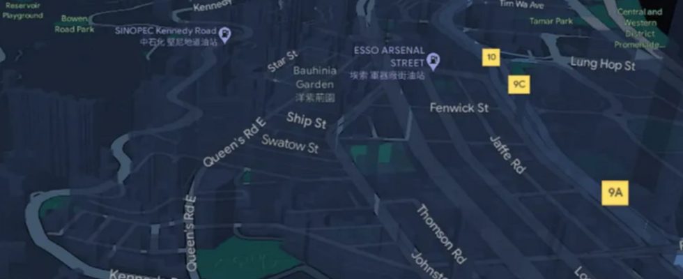
Google Maps 3D view: a sometimes annoying display
So the navigation view has changed, including on Android Auto, and buildings are now also represented. Streets, names and points of interest, such as gas stations, are still displayed, but buildings are clearly visible in their outlines. This makes addresses or stores even easier to find, as you no longer have to rely on street names and descriptions alone. Note that the Mountain View firm has adapted the 3D display to display the buildings transparently, so that they do not obstruct the view of the route. However, one might wonder whether such a display might not prove more annoying than anything else while driving. But it can be useful in case of many intersections.
This display is supported on mobile applications, but also on Android Auto and Apple CarPlay. To activate this new function, go to the settings after updating the application. Then go to the navigation settings, then to “Show map” and activate the “Show 3D buildings” option. This new feature is reminiscent of the DCE (Detailed City Experience) from Apple Plans. However, the rendering of the apple app is more elaborate, with more colors and details – in addition to the buildings, some trees are also displayed. Additionally, it also supports a day/night cycle with lights visible across buildings based on the time of day. Afterwards, buildings and other buildings on Google Maps remain discreet enough not to interfere with the most important information for navigation. In the worst case, it is always possible to deactivate this option if it is too unpleasant.