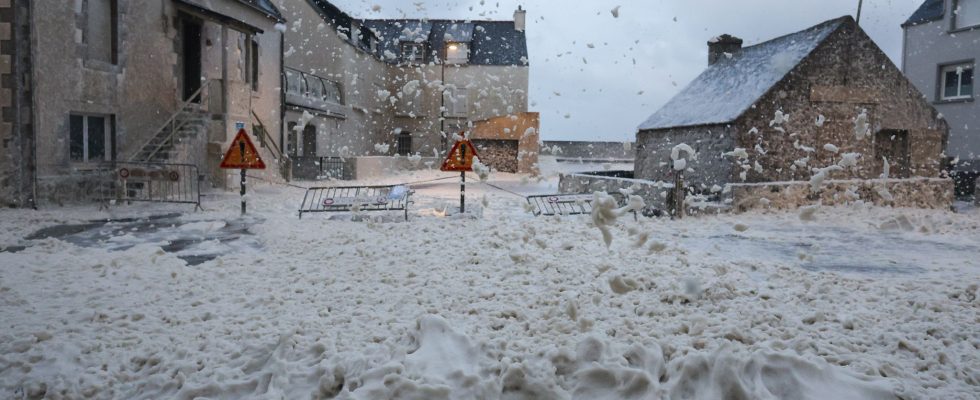
Is the hardest part over? The red “wind” vigilance was lifted on Thursday at 10 a.m. in Manche, the last of the three north-west departments still on maximum alert following the passage of storm Ciaran, which left one dead in Aisne. Among the damage: 1.2 million homes were deprived of electricity, including 780,000 in Brittany, according to Enedis. In total, 23 departments were still on orange alert at midday on Thursday throughout the Atlantic coast and the English Channel, as well as in the South-East and Corsica, indicates Météo-France.
These orange alerts concern risks linked to wind, rain but also waves-submersion. But what exactly are we talking about? According to Météo-France, they are linked to an extreme rise in sea level, itself due to the combination of several phenomena. First, there is the tide, a well-known normal process. The force is defined by a coefficient. The higher this coefficient, the higher the sea level at high tide. Added to this is the force of the wind: when there is a storm, it produces a rise in sea level, called a storm surge. Thus, it is the strong swell or waves that contribute to increasing the water height. There is also the wind “which exerts friction on the surface of the water, which generates a change in currents and sea level (accumulation of water as it approaches the coast)”, explains Météo-France .
Finally, the storm causes a decrease in atmospheric pressure (force exerted by the weight of the air). On Wednesday evening, Storm Ciaran caused the pressure to drop to 960 hPa near its center while it rose to 980 hPa in the morning at 9 a.m.
“The weight of the air then decreases at the sea surface and, mechanically, the sea level rises. A decrease in atmospheric pressure of one hectopascal (hPa) is approximately equivalent to a rise of one centimeter in the water height”, continues Météo-France. When the waves break, a movement of water masses spreads over the foreshore, in other words the area covered and uncovered by the tide. Consequences: coastal infrastructure can then be weakened or damaged, which is what the authorities fear. This Thursday morning, a wave of 21 meters was measured off the coast of Finistère, swept by storm Ciaran.
A peak between 12 p.m. and 2 p.m. in the Channel
When do these risks of marine submersion become maximum? Still according to Météo-France experts, they will wait for their peak between 12 p.m. and 2 p.m. on the Channel coasts. What about the precautions to take? Almost everywhere on the coast, calls for caution, particularly for walkers and boaters, have been relayed in the media or on social networks. These submersion waves are particularly devastating on the coast where walkers are regularly swept away. Whether on foot or by car, you should avoid driving along the seaside.
Due in particular to the risk of falling trees due to violent winds, the transport sector will operate slowly on Thursday in the west of the country. The Ministry of the Interior therefore recommends that residents of the coasts concerned keep abreast of developments in the situation by regularly following the news. Waves can also carry objects or pebbles with them, “which then become projectiles likely to injure people, damage property or obstruct traffic along the seaside”. warns Météo-France. The Atlantic maritime prefecture has also put itself in working order. It has prepositioned the powerful tugboat “Abeille Bourbon” in Ouessant to intervene in the event of difficulties encountered by ships.
Global warming can amplify the phenomenon
Extreme weather events (cyclones, heatwaves, floods, droughts, etc.) are natural phenomena. But global warming caused by greenhouse gas emissions generated by human activity can amplify them. Concerning more precisely the wave-submersion phenomena on the coasts, these risk becoming more dangerous with the rise in sea level linked to the melting of the ice, particularly during storms. The frequency of appearance of these giant waves would have increased by almost 50% globally in the space of 20 years.
Strong waves and marine flooding can be destructive phenomena. Floods due to marine submersion can, however, invade the coastline several kilometers inland and reach a water height of several meters. We remember the passage of storm Xynthia on February 27 and 28, 2010: the sea water had risen in places to more than two meters in the houses. That night, atmospheric conditions caused sea levels to rise by 1.53 m in La Rochelle, while sea levels were at their peak. The sea had then exceeded the level of the highest tides already observed by more than a meter.
