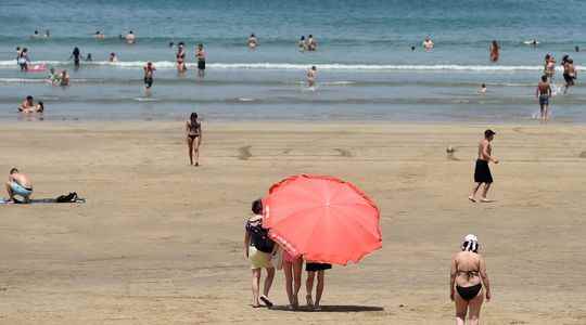
The heat is already back in France. While the month of May had been particularly hot, on June 18, absolute heat records were shattered, such as the 42.9°C recorded in Biarritz, Cap-Ferret (41.9°C) in the basin Arcachon or Biscarrosse in the Landes (41°C, 1968 record equaled). The symbolic bar of 40°C had also been reached elsewhere in the West, such as in Deux-Sèvres (Niort), in Charente-Maritime (Rochefort), in Ille-et-Vilaine (at La Noé-Blanche), in Maine-et-Loire (Angers) and Indre-et-Loire (Reignac).
This bar should still be crossed in the coming days. After a gradual rise in temperatures from the south this weekend, a heat wave – that is to say abnormally high temperatures observed for several consecutive days – is taking place from this Tuesday, July 12. The south-west of France will be particularly affected. If the temperatures will go down Thursday 14 and Friday, only on the northern half of France, they will then go up on these regions. “The whole territory could have scorching temperatures from Sunday July 17, but the intensity and duration of this episode will be to be specified,” said Matthieu Chevallier, head of the marine forecasting department of Météo-France on Monday. of a press briefing.
An upper low currently located near the Azores could play a role in the probable intensification of the heat wave at the end of the week. In a rotational movement, it could favor the gradual rise over the country of very hot air from Morocco and Spain, specifies Météo-France on its website. “The position of this cold drop, that is to say cold air positioned around 5000 meters above sea level which will isolate itself, remains to be determined and this is the reason why there there are still a lot of uncertainties at this stage,” says Sébastien Léas, forecaster at Météo-France.
A heat peak expected between July 16 and 19
The peak of this heat wave could take place “between Saturday and Tuesday July 19”, he explains. Concretely, the mercury will almost everywhere exceed 35 degrees on Sunday and Monday, or even Tuesday, July 19. It could even approach 40 degrees, including in the Paris region, in the center and in the northeast. For the rest, no stormy deterioration that could lower the thermometer is expected, explains Sébastien Léas. He completes: “The temperatures will then drop but they will remain above average”. In total, the heat wave could therefore last “at least 8 to 10 days” in France according to forecasts from the meteorological institute.
It is tempting to draw a parallel between the current situation and the heat wave of 2003. But, at the time, this heat wave took place between August 1 and 15, with a temperature of 35 degrees over two thirds of the territory during about two weeks. “It is still too early to say that a heat wave like that of 2003 awaits us for this month of July”, estimates Sébastien Léas. “We can rather compare the situation to July 2019, when 20 departments were placed on red alert for a heat wave”, says Virginie Hilssone-Lévyweather reporter at BFMTV.
That year, the episode had been “short and intense”, between July 21 and 26, recalls Matthieu Sorel, climatologist at Météo-France. He had recorded the temperature “the highest with an average of 29.4 degrees during the day and an average night temperature of 21.4 degrees”, he recalls. A month earlier, on June 28, 2019, an absolute temperature record in mainland France had been recorded in Vérargues, in Hérault, where the thermometer had risen to 46 degrees. The summer of 2019 is therefore reminiscent of the situation that France is about to experience this summer, with two heat waves in the space of barely a month.
Asked by Release, climatologist Christophe Cassou believes that “in the next few days, we will probably approach the heat wave of 2003, or even perhaps exceed it”. “Even if it is still too early to tell, the current heat wave could be more intense and longer still. It could last a very long time, especially in the south of France”, estimates the main author of the sixth report of the Intergovernmental Panel on Climate Change (IPCC).
Earlier, more intense and later heat waves
For scientists, the multiplication, intensification and lengthening of heat waves, aggravated by greenhouse gas emissions, constitute an unequivocal marker of global warming. “Without any possible ambiguity, the warming is taking shape ever stronger and more marked and is explained by the increase in greenhouse gas emissions”, summarizes climatologist Hervé Le Treut with L’Express. While some departments have sometimes been able to avoid heat waves in the past, such as the Channel, none will really be spared by heat waves in the future. “Greenhouse gas emissions are global, so there’s no reason it shouldn’t affect everyone”, explains Hervé Le Treut, before specifying that “the world of tomorrow will be different from that of today. today.”
Sébastien Léas expects the summer of 2003 “to be the norm at the end of the century”. We are therefore experiencing a taste of the future climate. Episodes of high heat, which now arrive in France in June, could also be later in the future, why not in September. “These heat waves will become earlier, more intense and later due to global warming”, summarizes Matthieu Sorel. “A temperature of 35 degrees is now often reached and the threshold of 40 degrees is also starting to be regularly reached,” he observes.
“What is worrying is the intensity, the recurrence and the change in seasonality of these peaks”, underlines Christophe Cassou with Release. France has experienced 44 heat waves since 1947, the last of which dates back to June. “Over the past 35 years, they have been three times more numerous than over the previous 35 years. The number of days of heat waves has increased ninefold”, recalls Météo-France. It is in July that France lists the most. What aggravate the risk of drought but also forest fires.
