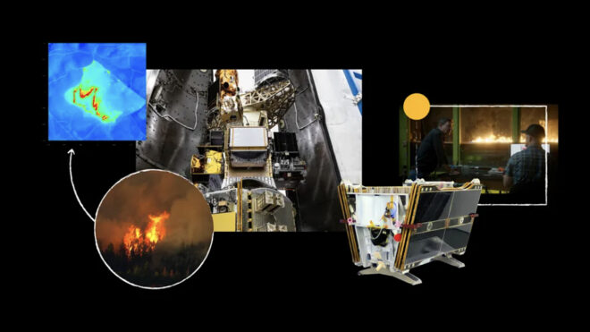
Internet giant Google, the first Fireat satellite to help to detect forest fires early threw.
Google aims to send more than 50 Firesat satellites that will receive artificial intelligence to identify and monitor forest fires in orbit, and took the first satellite to space with SpaceX’s Transporter-13 mission. “Currently, many institutions are currently relying on satellite images with low resolution or updated only several times a day. Fireresat will globally provide high -resolution images that are updated every 20 minutes and make the fight against forest fires much more effective. ” Google, Fireresat Google Research, Muon Space, Earth Fire Alliance, Moore Foundation and many official institutions are prepared with the support of the said.
You may be interested in
Google does not come up for the first time in terms of fire. Company Forest Fire Receiving or Border Tracking System in the last year Andorra, Bosnia and Herzegovina, Croatia, Cyprus, France, Greece, Italy, Kenya, Monako, Montenegro, Portugal, Rwanda, Slovenia, Spain And Türkiye He also activated. “Call” And “Maps” The results of the artificial intelligence supported fire shown in it, It takes advantage of multiple data/image and reveals the area covered by the fires.. Focusing on the protection of people from fire with location -based notifications, the system is constantly made better as it is transferred.
Google’s earthquake warning system has been working in Türkiye for a long time. So how exactly does this earthquake warning system work? Very advanced in android phones accelerator Sensors such as. Thanks to these sensors, phones can perceive even the slightest movement. Google using it Android It sets up an earthquake network from the phones and can be notified in advance.