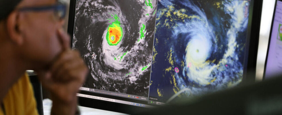
Freddy, who has become a “strong tropical storm”, will not re-land on the Big Island, as on February 21: this is what Météo Madagascar has just announced. This Monday evening, it had already caused deaths on the west coast of the island.
With our correspondent in Antananarivo, Sarah Tetaud
It is a rare weather phenomenon that Madagascar is experiencing. On February 21, the very intense tropical cyclone Freddy, formed in the Australian basin, came crashing down on the east coast of the island. Assessment: 7 dead and nearly 120,000 victims. After coming out through the Mozambique Channel to cause further damage in Mozambique and Zimbabwe, Freddy has made the opposite journey and has been flirting again less than 50 km from the Malagasy coast since Sunday. Result: major floods on the south-west coast and already two deaths and almost 3,000 victims have been recorded. Its proximity to the coast leads to torrential rains causing flooding
This astonishing trajectory, operated in less than fifteen days in the Mozambique Channel, is very rare, explains Rivo Randrianarison, head of the Malagasy Meteorology forecasting service: “ It is here in the Indian Ocean, that we encounter the most atypical systems, if we compare them to the cyclonic basins of the whole world. Freddy, that’s really rare. To find a trajectory like his, we have to go back to the archives of the year 1998 to find a system called Beltane. Except Beltane wasn’t a cyclone, it was just a tropical storm. »
Watch out for sudden river floods
Since Sunday, Freddy has been evolving off Tulear, bringing with him torrential rains. This Monday evening, four districts were still placed on red alert by the authorities. ” Over the past two days, rainfall has affected the western, southwestern and extreme southern regions of the country quite a bit. The main risks caused by these heavy rains are floods, river floods and landslides. »
The National Office for Risk and Disaster Management also calls on the population to be extremely vigilant and lists a series of recommendations to follow for the next 48 hours. ” Avoid going to sea. This is really very very inadvisable given that the cyclone is still off the south west region says Colonel Faly Fabien coordinates emergency operations.
” Second recommendation, it is really not to forget that the cyclone, inland, brings a lot of rain. And so upstream of the watersheds, with the Fiherenana, Onilahy, Menarandra rivers, up to Ampanihy, there are risks of “flashing”. We invite people who use the national roads, crossed by these rivers cross the national roads to be really careful. Because the water levels, and especially the speed and strength of these flash floads, are likely to wash away even large vehicles. »
The risk of flooding by marine submersion is also high today, due to the high tide. A dangerous situation, which should last another 72 hours, the time to let Freddy move away from the Malagasy coast, to touch again… Mozambique.
