A powerful southerly flow continues to bring large amounts of Saharan sand over the country until Thursday. Discover the images of the southwest covered in sand, from the mountains of the Pyrenees to the coasts of the Atlantic.
A vigorous flow from south to south-east, called “sirocco” in meteorology, colored the skies of the Maghreb, Spain and a large part of France. This brings upair sweet, but also makes you travel cloud of sand from the Sahara to France and beyond, towards the British Isles and the Netherlands.
The wind blew up to 110 km / h in North Africa and the autan wind up to 100 km / h in the Southwest on Monday, propelling these dust particles across the whole region. A situation that occurs on average one to three times a year in the south of France, with varying intensity.
The amounts of dust from #sand from #Sahara are still important on the majority of the #France this Wednesday with a sky that often looks milky or even yellowish at times. The situation will improve in the coming days.
Maps via SKIRON Forecast pic.twitter.com/nxm8nsvnnQ
— Guillaume Séchet (@Meteovilles) March 16, 2022
Dusty skies, colorful mountains and a pollution episode
This week’s episode, one of the strongest in the last 10 years, especially this Tuesday, and a significant layer of sand covered the Pyrenean peaks, making them look like Sahara dunes! This coloring of coat Pyrenean snowfall will have an effect on thealbedoby reducing the reflectivity of the snow: therefore, brown snow should melt much faster than white snow.
Sand is also present on the roadways and cars from the Occitanie region to Ile-de-France, including Paris after the sandy rains of Monday evening and Tuesday morning, an exceptional event.
That rising sand is not insignificant, since during the strongest episodes, a fine particle pollution peak can be registered. This degradation of air quality linked to particles PM10 is likely to aggravate respiratory problems in people who are already susceptible. This sand contains not only pollutants, but also bacteria and mushrooms.
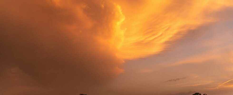
This atmosphere dusty also has another consequence, that of veiling the sky, and even coloring it during the strongest episodes. This past Tuesday and Wednesday, the sky appeared hazy over a large part of the country, limiting the intensity of the rays of Sun. This milky sky took on an orange color over three quarters of the country, as has already happened in recent years in the same type of weather situation. Due to this sand-laden cloud cover, the temperatures that were expected to soar on Wednesday are ultimately lower than expected. The phenomenon will continue this Thursday, before a change in the direction of the winds and the return of the rain between Thursday evening and Friday morning.
In Algeria and Spain on Monday, the sky turned red, giving an apocalyptic atmosphere over southern Europe and the Maghreb.
Interested in what you just read?