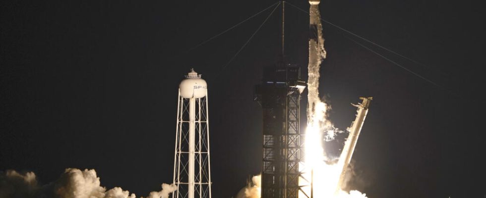
Called “Taifa-1” (Nation-1, in Swahili), the first Kenyan observation satellite is due to take off on Tuesday, April 11 from the American base in Vandenberg, California, aboard a Falcon 9 rocket from the company. American company Space X. Interview with Colonel Brig Hillary Kipkosgei, Acting Director of the Kenya Space Agency (KSA).
A small object – 10 cm by 10 cm wide and 30 cm long – but a great moment for the Kenyan space agency. Ihe first Kenyan observation satellite must take off this Tuesday morning at 6:48 UT to deploy an hour later. In 2018, the country had already launched a first nanosatellite, but only on an experimental basis. The one that is to reach space will indeed be the first operational observation satellite, in other words the first to be able to collect and transmit satellite data in real time.
Taifa-1 was designed and developed in Nairobi by a team of Kenyan engineers at an estimated cost of 50 million shillings (approximately 350,000 euros), in collaboration with the Bulgarian company Endura Sat, which handled the manufacturing and testing of certain parts of the satellite. Kenya hopes to start receiving data from August. By then, he must complete the manufacture of the receiver on the ground and allow time for Taifa-1 to stabilize and the teams to configure it. It will be the 46th African satellite to be placed in orbit, 25 years after the first, an Egyptian satellite launched in 1998. According to the Kenyan authorities, the data collected should help improve the management of the country’s natural resources and help the agricultural sector.
RFI: What will the data collected and transmitted by Taifa-1 be used for?
Brig Hillary Kipkosgey: This will allow us to monitor, for example, our forest cover. Are we losing forests or does our reforestation policy allow us to increase our forest area? As far as water resources are concerned, it can help monitor whether we are losing water or whether volumes are increasing, or even detect sources of pollution.
Will it also help you with dryness?
Drought ? In a certain way. But to monitor the drought, a satellite that provides images is not enough. We also need sensors on the ground and a larger satellite which, from these sensors, can assess whether there is a drop in soil humidity and therefore a risk of drought.
Our satellite, because it is small, does not have this capability. But for us, it’s a step, a springboard. We are learning to build satellites. We started, in 2018, with a satellite three times smaller than this one and since then we have made progress.
What are the next steps ?
Already, we want to show what we are capable of. We have reached a certain maturity. Then we want, thanks to this satellite, to continue learning. This is our first operational satellite, so there are things to learn about managing a space operation, about managing a receiver on the ground. In terms of data acquisition and processing, we also have things to learn.
And later, we want to use this knowledge to launch other satellites… Three, four, five and maybe even six satellites that will work together and form a constellation. The objective is to have varied sources of information which complement each other and which can be compared.
Finally, our space program is little known. People don’t know our capabilities and the opportunities that this represents. So we want to take this opportunity to raise awareness and to gain their support so that we can invest in other programs in the future.