Like our rivers, the underwater world also has its system of channels, in which sediment-laden fluids flow. A new mission off the Canadian coast reveals the morphology of the longest of them.
You will also be interested
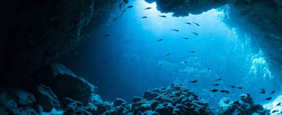
[EN VIDÉO] Beauty of ocean currents This computer model reveals the beauty and complexity of the ocean currents observed from space between June 2005 and December 2007. © Nasa/Goddard Space Flight Center/YouTube
Channels and canyons are not a continental specificity. This type of incision is also found in the marine environment. Amazing? Not that much. If the channels are created on the continents by the course of the rivers, in the marine environment, they are created by the flow of fluids denser than the sea water which descends the slopes of the continental slopes.
The similarity between these underwater channels and our rivers is also striking: meanders, levees, areas of deposits or erosion… The architecture of these two types of channel systems is very similar. Just as much as the fluvial channels at Earthocean channels are essential to the functioning of major sedimentary and biogeochemical cycles.
Real underwater rivers
In fact, in the same way that rivers transport sedimentary particles from erosion zones to deposit zones, underwater channels distribute eroded continental material towards the open sea. But not only that. They contribute to redistribute very widely the carbon as well as nutrients as the ironthe calciumthe phosphorus and the sulfide, so important to marine organisms. They are truly the relay terrestrial river systems.
The Bengal channel, for example, thus transports enormous quantities of eroded sediments on the Himalayan slopes and redistributes them in the Indian Ocean, thus contributing up to 10 to 20% to the burial of global organic carbon. These systems therefore play a major role in the carbon storage, and therefore for the climatic balance over geological time. This large storage capacity also makes them ideal areas for the maturation of hydrocarbonsespecially in the deep margin areas.
Significant sediment transport
The formation of these submarine canyons and channels is linked, not to the flow of water, under which they lie, but to the flow of currents of turbidity. Turbidity currents are sediment-laden water flows. Their high density relative to the surrounding seawater causes them to flow, like a river, at bottom level. They are mainly driven by gravity on the slopes of the continental slopes which border the coasts. Their flow can then turn into a kind ofavalanches submarines which can reach very strong gears, of the order of 70 km/h. The intensity of this type of flow will erode the sedimentary bottom and dig channels. The sediments thus transported will be deposited in the abyssal plainin the form of lobes, which are called “turbidites”.
It is common to find underwater channels over 100 km long, such as that of Bengal, where those at the mouth of large rivers such as the Amazon, the Mississippi or the Nile. But the longest known to date is off Newfoundland in the North Atlantic. Called Namoc for Northwest Atlantic Mid-Ocean Channelit is 3,800 km long and connects Hudson Bay to the Atlantic Abyssal Plain, passing through the Labrador Sea and the Grand Banks region of Newfoundland.
Unlike the other examples cited above, this channel is not fed by a large river, but by glacier meltwater of the North American ice cap. Discovered in 1949, the Namoc remained a mystery for a long time because of the difficulty of imaging by bathymetry a relatively narrow structure (less than 5 km wide). Scientists have therefore set up a mission at sea (MSM102) in order to acquire new data specifically on this area and image the morphology detail of the channel.
A morphology similar to rivers but different processes
The axis of the channel was thus imaged from end to end with great precision. The results reveal the astonishing morphology of this channel submarinewith its many meanders and tributaries (see the video below).
Guided tour of one of the longest underwater channels on Earth. This animation shows an overview of part of the Namoc Channel, an undersea channel that stretches over 3,800 kilometers from Hudson Strait in the north, through the Labrador Sea and around the Grand Banks- New. © AGU
Although theanalogy with rivers on land is obvious, the hydraulic and sedimentary processes are quite different. In the marine environment, the flow dynamics are mainly dictated by the contrast density between the turbidity current and seawater. Unlike rivers, the highest velocities are found at the base of the channel, not at the surface of the flow.
These data will of course be used to better understand the processes physical involved in the transport of sediments to the sea floor, to examine the role of turbidity currents and Coriolis forcethe filing of masses sediments in the ocean environment, etc.
Interested in what you just read?