Farmers continue to block roads throughout France and organize the “siege” of Paris. To avoid unpleasant surprises, prepare your journeys in advance using these maps showing the main road and motorway blockages.
For several days, angry farmers have been demonstrating and blocking the roads of France in order to denounce the constraints of the ecological transition on their activity and the reductions in funding in their sector. After the pandemic and the war in Ukraine, which had an impact on production costs, the national versions of the European Green Deal are fueling anger, because they are perceived as too many standards. The blockages of roads and motorways are thus a way of putting pressure on the Government so that serious measures are taken to emerge from this crisis, those announced last Friday by Gabriel Attal being considered insufficient. This Monday, January 29, the movement takes a new step with the organization of the “siege” of Paris. And suffice to say that it’s a hell of a mess to be able to move around France!
Farmers’ blockades in France: maps to monitor the situation
The unions of the National Federation of Farmers’ Unions (FNSEA) and Young Farmers have called for the blocking of the Chennevières area on the A1, of the A4 at Jossigny, of the Total station of Ourdy on the A5, the Pont de Villabé on the A6, the Longvilliers bridge on the A10, the Buchelay toll (Yvelines side) on the A13, the Gennevilliers bridge and the D311 on the A15, and the Isle-Adam interchange on the A16. At the same time, operations carried out by independent groups also take place. Rural Coordination, a union with different positions from the FNSEA, for its part called for a blockade of the Rungis market. But the movement is spreading throughout France, and not just in Paris. Other large cities, such as Lyon, are also affected, while dams are visible in most regions: Ile-de-France, Auvergne Rhône-Alpes, Provence-Alpes-Côte d’Azur, Occitanie, Nouvelle Aquitaine, Brittany or Normandy. In the end, there were around fifty blockages and demonstrations throughout the country.
In several large cities, taxis have also decided to disrupt traffic, by striking against the new medical transport prices established by Health Insurance, with numerous snail operations. Thus, on the Marseille side, the A50, A7 and A55 motorways are the subject of snail operations at the initiative of taxi drivers, while several hundred taxis from several departments in the region are expected in Bordeaux.

If you have a journey to make, we strongly advise you to check the road and traffic conditions before leaving. Several websites have set up maps, regularly updated, which indicate the different blockages. This is the case of L’Internaute (to see here), which indicates the main road and motorway blockages, and BFMTV (available here), which also takes into account disruptions caused by taxis.
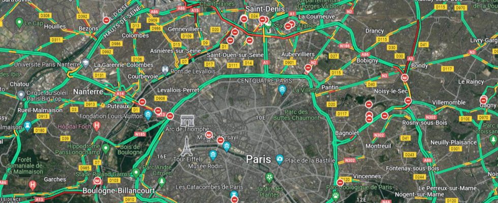
We also invite you to take a look at Google Maps and, for those who live in the Paris region, Sytadin, which display incidents unrelated to farmers’ operations and which therefore do not appear on other maps. On Google’s mapping service, you must display the Traffic layer to get an overview of the situation, with the display of prohibited direction signs and roads in red when they are impassable. On Sytadin, different icons will tell you if the roads are blocked due to demonstrations, works, accidents or vehicle breakdowns. In short, look at several maps in order to have a complete view of the situation and optimize your journey as much as possible!